Ogallala in Keith County, Nebraska — The American Midwest (Upper Plains)
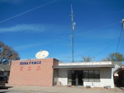
KOGA AM & FM
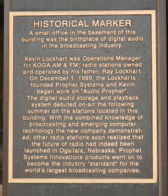
Historical Marker
Kevin Lockhart was Operations Manager for KOGA AM & FM; radio stations owned and operated by his father, Ray Lockhart. On December 1, 1989, the Lockharts founded Prophet Systems, and Kevin began work on “Audio Prophet”. The digital audio storage and playback system debuted on-air the following summer on the stations located in this building. With the combined knowledge of broadcasting and emerging computer technology the new company demonstrated, other radio stations soon realized that the future of radio had indeed been launched in Ogallala, Nebraska. Prophet Systems Innovations products went on to become the industry “standard” for the world’s largest broadcasting companies.
Topics. This historical marker is listed in this topic list: Communications. A significant historical month for this entry is December 1488.
Location. 41° 7.647′ N, 101° 43.219′ W. Marker is in Ogallala, Nebraska, in Keith County. Marker is on West 4th Street, on the right when traveling west. Touch for map. Marker is at or near this postal address: 113 West 4th Street, Ogallala NE 69153, United States of America. Touch for directions.
Other nearby markers. At least 8 other markers are within walking distance of this marker. End of the Texas Trail (about 400 feet away, measured in a direct line); Standard Oil Gas Station (about 400 feet away); Keith County Veterans Memorial (about 500 feet away); The Pony Express (about 600 feet away); The Mormon Trail (about 600 feet away); California Hill (about 700 feet away); The Union Pacific (about 700 feet away); Highways 26 and 92 (about 700 feet away). Touch for a list and map of all markers in Ogallala.
Additional keywords. digital storage
Credits. This page was last revised on June 16, 2016. It was originally submitted on November 23, 2013, by Barry Swackhamer of Brentwood, California. This page has been viewed 532 times since then and 25 times this year. Photos: 1, 2. submitted on November 23, 2013, by Barry Swackhamer of Brentwood, California. • Andrew Ruppenstein was the editor who published this page.

