Fallon in Churchill County, Nevada — The American Mountains (Southwest)
Churchill County Courthouse
10 W. Williams
Inscription.
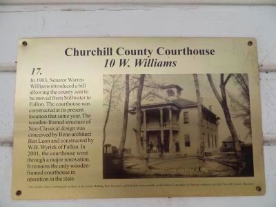
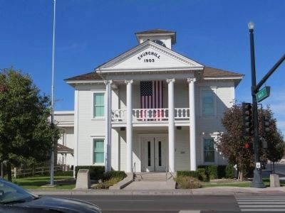
In 1903, Senator Warren Williams introduced a bill allowing the county seat to be moved from Stillwater to Fallon. The courthouse was constructed at its present location that same year. The wooden-framed structure of Neo-Classical design was conceived by Reno architect Ben Leon and constructed by W.B. Wyrick of Fallon. In 2001, the courthouse went through a major renovation. It remains the only wooden-framed courthouse in the state.
Erected by Fallon Convention and Tourism Authority. (Marker Number 17.)
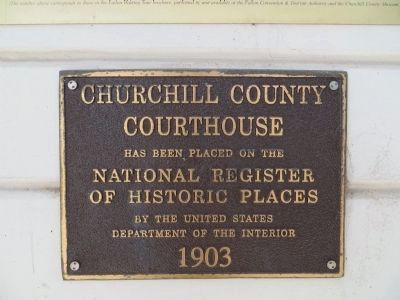
Topics. This historical marker is listed in these topic lists: Architecture • Government & Politics • Political Subdivisions. A significant historical year for this entry is 1903.
Location. 39° 28.497′ N, 118° 46.674′ W. Marker is in Fallon, Nevada, in Churchill County. Marker is on West Williams Avenue near Lincoln Highway (U.S. 50). Touch for map. Marker is at or near this postal address: 10 West Williams Avenue, Fallon NV 89406, United States of America. Touch for directions.
Other nearby markers. At least 8 other markers are within 9 miles of this marker, measured as the crow flies. A different marker also named Churchill County Courthouse (within shouting distance of this marker); Old Post Office (about 500 feet away, measured in a direct line); Oats Park School (approx. half a mile away); The Brothers of E.C.V. (approx. 6.8 miles away); Carson Trail - Ragtown (approx. 7˝ miles away); Ragtown (approx. 7.8 miles away); Grimes Point (approx. 8.6 miles away); Grimes Point Archaeological Area (approx. 8.6 miles away). Touch for a list and map of all markers in Fallon.
Credits. This page was last revised on December 20, 2020. It was originally submitted on November 30, 2013, by Bill Kirchner of Tucson, Arizona. This page has been viewed 584 times since then and 17 times this year. Photos: 1, 2, 3, 4. submitted on October 24, 2013, by Bill Kirchner of Tucson, Arizona. • Syd Whittle was the editor who published this page.


