Arco in Butte County, Idaho — The American West (Mountains)
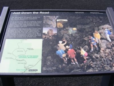
Just Down The Road
Craters of the Moon National Monument
-Comment from an early traveler.
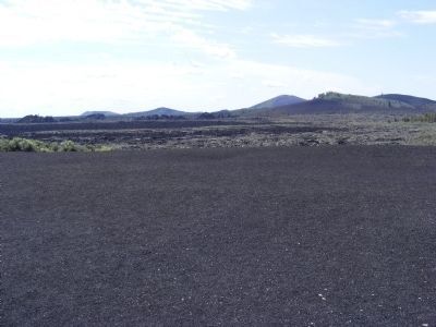
The landscape before you was explosively created by volcanic eruptions. Cracks in the earth’s crest allowed lava to blast, plop, and flow onto the surface to form such unusual features as cinder cones, monoliths, and caves. The entrance to this imposing place, known today as the Craters of the Moon National Monument, is just down the road. Stop at the visitor center to see the exhibits, then take the seven-mile loop drive through the monument. Craters of the Moon offers a variety of experiences for those who want to explore this unusual ocean of black rock. (Inscription in the photo) The moon-like landscape includes monoliths, cinder cones, and seasonal wild flowers.
Erected by National Park Service-United States Department of the Interior.
Topics. This historical marker is listed in this topic list: Environment.
Location. 43° 27.813′ N, 113° 33.593′ W. Marker is in Arco, Idaho, in Butte County. Marker is on U.S. 20. Touch for map. Marker is in this post office area: Arco ID 83213, United States of America. Touch for directions.
Other nearby markers. At least 8 other markers are within 2 miles of this marker, measured as the crow flies. Get over it! (approx. 0.2 miles away); Vanishing Landmark (approx. ¼ mile away); Where's the Volcano? (approx. ¼ mile away); North Crater Flow Trail (approx. 0.4 miles away); North Crater Lava Flow (approx. 0.4 miles away); Devil's Orchard Trail (approx. 1.4 miles away); Are We Loving Them to Death? (approx. 1½ miles away); Silent Cone (approx. 1.6 miles away). Touch for a list and map of all markers in Arco.
Credits. This page was last revised on June 16, 2016. It was originally submitted on December 5, 2013, by Don Morfe of Baltimore, Maryland. This page has been viewed 783 times since then and 12 times this year. Photos: 1, 2, 3, 4. submitted on December 5, 2013, by Don Morfe of Baltimore, Maryland. • Syd Whittle was the editor who published this page.


