Petersburg, Virginia — The American South (Mid-Atlantic)
“A Stupendous Failure”
Petersburg National Battlefield
— National Park Service, U.S. Department of the Interior —
Inscription.
“It is agreed that the thing was a perfect success, except that it did not succeed.”
- Major Charles F. Adams, Jr., USA
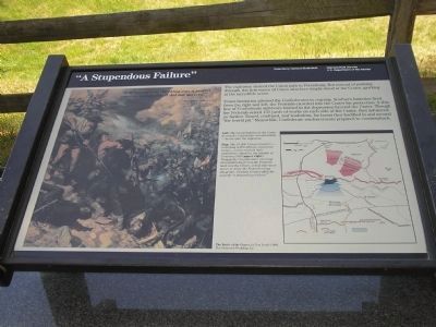
The explosion cleared the Union path to Petersburg. But instead of pushing through, the first waves of Union attackers simply stood at the Crater, gawking at the incredible scene.
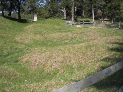
Union hesitation allowed the Confederates to regroup. Southern batteries fired from right and left; the Federals crowded into the Crater for protection. A thin line of Confederate survivors formed in the depression beyond the Crater. Though the Federals seized 150 yards of works on each side of the Crater, they advanced no farther. Dazed, confused, and leaderless, for hours they huddled in and around “the horrid pit.” Meanwhile, Confederate reinforcements prepared to counterattack.
Erected by National Park Service, U.S. Department of the Interior.
Topics. This historical marker is listed in this topic list: War, US Civil.
Location. 37° 13.114′ N, 77° 22.65′ W. Marker is in Petersburg, Virginia. Marker can be reached from Siege Road. Marker is in Petersburg National Battlefield. It is located on a walking trail that starts at Tour Stop 8. Touch for map. Marker is in this post office area: Petersburg VA 23803, United States of America. Touch for directions.
Other nearby markers. At least 8 other markers are within walking distance of this marker. Confederate Counterattack (here, next to this marker); The Crater (here, next to this marker); Crater of Mine (here, next to this marker); Confederate Countermine (a few steps from this marker); Mahone (within shouting distance of this marker); Second Pennsylvania Veteran Heavy Artillery (within shouting distance of this marker); Union High Tide (within shouting distance of this marker); South Carolina (within shouting distance of this marker). Touch for a list and map of all markers in Petersburg.
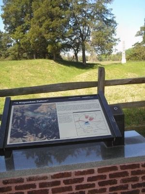
More about this marker. The left portion of the marker contains a picture of the Battle of the Crater, with the caption:Left: The brutal fighting in the Crater during the Confederate counterattacks – hours after the explosion.
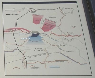
The lower right portion of the marker features a map of the battle with the caption: Map: The 15,000 Union attackers – including 4,300 African-American troops – never reached their immediate objective, the heights of Cemetery Hill (upper right). Through the Confederates’ morning counterattacks forced the Federals back into the Crater, it took four more hours to drive the Federals away altogether. General Grant called the episode “a stupendous failure.”
Also see . . .
1. Crater. CWSAC Battle Summaries. (Submitted on April 13, 2008, by Bill Coughlin of Woodland Park, New Jersey.)
2. Petersburg National Battlefield. National Park Service. (Submitted on April 13, 2008, by Bill Coughlin of Woodland Park, New Jersey.)
3. The Siege of Petersburg. (Submitted on April 13, 2008, by Bill Coughlin of Woodland Park, New Jersey.)
Credits. This page was last revised on February 2, 2023. It was originally submitted on April 13, 2008, by Bill Coughlin of Woodland Park, New Jersey. This page has been viewed 1,655 times since then and 26 times this year. Photos: 1, 2, 3, 4, 5. submitted on April 13, 2008, by Bill Coughlin of Woodland Park, New Jersey. • Craig Swain was the editor who published this page.
