Derry-Londonderry in Derry And Strabane, Northern Ireland, United Kingdom — Northwestern Europe (the British Isles)
Castle Gate
Demolish the walls
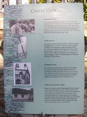
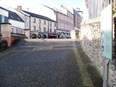
The Maiden City withstood two sieges without its walls being breached. In the 18th century the city grew too big for its walls and increasingly houses and factories were built on the slopes below. Castle Gate (1803) was the second breach in the walls to deal with increased traffic. Thirty years later businessmen campaigned to demolish the walls entirely to solve the traffic problems. They failed and traffic continued to clog the city's streets.
The Burnderries
Local Irish chief Cahir O'Doherty rebelled in 1608. He attacked 'the sleeping city' at 2am on 19th April and by dawn had taken it. The town was wholly spoiled, ransacked and fired, the most part of the women stripped and led away prisoners. Two months later the English recaptured the city. The head of Sir Cahir and his foster father Riabhach MacDhaibhéid were displayed on a spike at Newgate in Dublin. The MacDhaibhéid clan were later nicknamed 'The Burnderries'.
O'Doherty's Tower
The building that houses the Tower Museum was modeled on the late 15th century castle that once stood near here. The O'Doherty family of Inishowen built the tower house for their overlords, the O'Donnells of Tir Connaill. They paid for the land with 'twenty cows'. The tower house was used as a magazine or ammunition store for the Plantation city.
Paddy's folly and Bridie's Thatch
Builder and community activist 'Paddy Bogside' Doherty sought to restore the shattered heart of the city. Part of his vision to create employment and give people a pride in their shared history was to reconstruct O'Doherty's tower, completed in 1986. The award-winning Tower Museum opened in the building six years later. Doherty also built the Craft Village with its recreated traditional thatched cottage. We called the tower Paddy's Folly because he went ahead and built it when everything around it was being destroyed. It gave us hope at a very bad time.
Topics. This historical marker is listed in these topic lists: Disasters • Forts and Castles • Settlements & Settlers. A significant historical year for this entry is 1608.
Location. 54° 59.811′ N, 7° 19.316′ W. Marker is in Derry-Londonderry, Northern Ireland, in Derry And Strabane. Marker is on the city wall walking path near Castle Gate, just north of the intersection of Castle Street and Magazine Street. Touch for map. Marker is in this post office area: Derry-Londonderry, Northern Ireland BT48 6HJ, United Kingdom. Touch for directions.
Other nearby markers. At least 8 other markers are within walking distance of this marker. A different marker also named Castle Gate (a few steps from this marker); Hangman's Bastion (within shouting distance of this marker); Shipquay Street (about 90
meters away, measured in a direct line); Magazine Gate (about 90 meters away); a different marker also named Magazine Gate (about 120 meters away); Butcher Gate (about 120 meters away); Guildhall Square (about 120 meters away); Michael Browning (about 120 meters away). Touch for a list and map of all markers in Derry-Londonderry.
Also see . . .
1. History of Derry, Ireland. (Submitted on December 29, 2013, by William Fischer, Jr. of Scranton, Pennsylvania.)
2. Historic Walls of Derry. (Submitted on December 29, 2013, by William Fischer, Jr. of Scranton, Pennsylvania.)
Credits. This page was last revised on September 7, 2022. It was originally submitted on December 29, 2013, by William Fischer, Jr. of Scranton, Pennsylvania. This page has been viewed 582 times since then and 8 times this year. Photos: 1, 2. submitted on December 29, 2013, by William Fischer, Jr. of Scranton, Pennsylvania.

