Danville in Boyle County, Kentucky — The American South (East South Central)
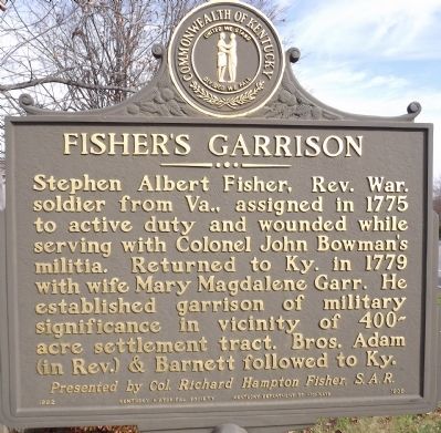
Fisher's Garrison
Presented by Col. Richard Hampton Fisher, S.A.R.
Erected 1992 by Col. Richard Hampton Fisher, S.A.R. & Kentucky Historical Society & Kentucky Department of Highways. (Marker Number 1909.)
Topics and series. This historical marker is listed in these topic lists: Colonial Era • Patriots & Patriotism • Settlements & Settlers • War, US Revolutionary. In addition, it is included in the Kentucky Historical Society series list. A significant historical year for this entry is 1775.
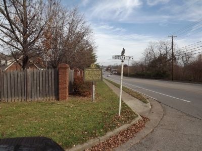
Location. 37° 39.161′ N, 84° 45.486′ W. Marker is in Danville, Kentucky, in Boyle County. Marker is at the intersection of Lexington Street (Kentucky Route 34) and Cecilian Terrace, on the right when traveling west on Lexington Street. Touch for map. Marker is at or near this postal address: 404 Cecilian Terrace, Danville KY 40422, United States of America. Touch for directions.
Other nearby markers. At least 8 other markers are within walking distance of this marker. John William Bate (approx. 0.8 miles away); Willis Russell House / Craddock and Tardiveau (approx. 0.8 miles away); Lewis and Clark in Kentucky - Danville (approx. 0.8 miles away); Fisher’s Row (approx. 0.8 miles away); Watts-Bell House (approx. 0.8 miles away); Dr. Mary E. Britton (approx. 0.8 miles away); John Gill Weisiger Memorial Park (approx. 0.8 miles away); First Post Office (approx. 0.8 miles away). Touch for a list and map of all markers in Danville.
Credits. This page was last revised on June 16, 2016. It was originally submitted on December 30, 2013, by Ken Smith of Milan, Tennessee. This page has been viewed 649 times since then and 37 times this year. Photos: 1, 2. submitted on December 30, 2013, by Ken Smith of Milan, Tennessee. • Al Wolf was the editor who published this page.

