Marker Logo HMdb.org THE HISTORICAL
MARKER DATABASE
“Bite-Size Bits of Local, National, and Global History”
Harrisburg in Dauphin County, Pennsylvania — The American Northeast (Mid-Atlantic)
 

Harrisburg Cemetery


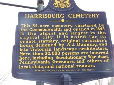
Harrisburg Cemetery Marker image. Click for full size.
Photographed By William Pfingsten, April 12, 2008
1. Harrisburg Cemetery Marker
Inscription. This 35-acre cemetery, chartered by the Commonwealth and opened in 1845, is the oldest and largest in the capital city. It is noted for its ornate statuary, original caretaker's house designed by A.J. Downing, and late Victorian landscape architecture. More than 30,000 persons are interred here, including Revolutionary War dead, Pennsylvania Governors, and others of local, state and national renown.
 
Erected 1990 by Pennsylvania Historical and Museum Commission.
 
Topics and series. This historical marker is listed in these topic lists: ArchitectureCemeteries & Burial SitesWar, US Revolutionary. In addition, it is included in the Pennsylvania Historical and Museum Commission series list. A significant historical year for this entry is 1845.
 
Location. 40° 16.159′ N, 76° 52.297′ W. Marker is in Harrisburg, Pennsylvania, in Dauphin County. Marker is at the intersection of State Street and 13th Street, on the left when traveling east on State Street. Touch for map. Marker is in this post office area: Harrisburg PA 17104, United States of America. Touch for directions.
 
Other nearby markers. At least 8 other markers are within walking distance of this marker. In Honor of the Revolutionary Soldiers Buried in the Harrisburg Cemetery (about 300 feet away, measured in a direct line); a different marker also named Harrisburg Cemetery (about 500 feet away); J. Henry Chayn
Paid Advertisement
Click on the ad for more information.
Please report objectionable advertising to the Editor.
Click or scan to see
this page online
(about 500 feet away); Harrisburg Cemetery Caretaker's Cottage (about 500 feet away); W. F. Richardson (about 600 feet away); Samuel F. Keller (about 700 feet away); Soldiers and Sailors Memorial Bridge (about 700 feet away); Capt. George A. Brooks (approx. 0.2 miles away). Touch for a list and map of all markers in Harrisburg.
 
Related marker. Click here for another marker that is related to this marker. Another Harrisburg Cemetery markers with photos.
 
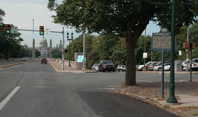
Harrisburg Cemetery Marker image. Click for full size.
Photographed By Howard C. Ohlhous, September 22, 2015
2. Harrisburg Cemetery Marker
Facing to the west on State Street, at the corner of N 13th Street.
Flowering trees and shrubs in a natural setting were hallmarks of the 19th century cemetery. image. Click for full size.
Photographed By John K. Robinson, April 13, 2006
3. Flowering trees and shrubs in a natural setting were hallmarks of the 19th century cemetery.
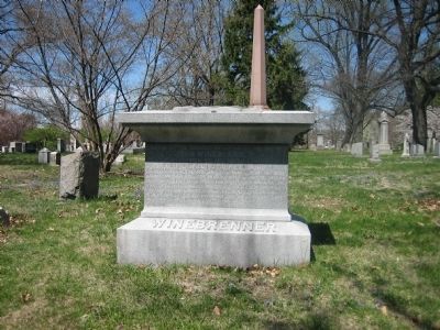
John Winebrenner was the founder of the Churches of God, General Conference. image. Click for full size.
Photographed By John K. Robinson, April 13, 2006
4. John Winebrenner was the founder of the Churches of God, General Conference.
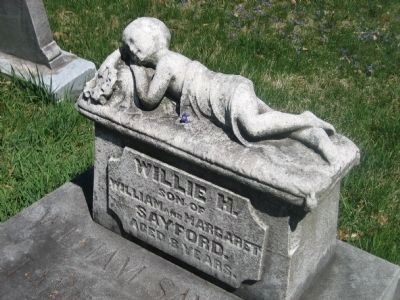
Little Willie H. lies at ease for all eternity. image. Click for full size.
Photographed By John K. Robinson, April 13, 2006
5. Little Willie H. lies at ease for all eternity.
 
 
Credits. This page was last revised on December 5, 2019. It was originally submitted on April 14, 2008, by Bill Pfingsten of Bel Air, Maryland. This page has been viewed 1,729 times since then and 17 times this year. Photos:   1. submitted on April 14, 2008, by Bill Pfingsten of Bel Air, Maryland.   2. submitted on October 11, 2015, by Howard C. Ohlhous of Duanesburg, New York.   3, 4, 5. submitted on May 17, 2008, by John K. Robinson of Harrisburg, Pennsylvania.
Share this page.  
Share on Tumblr
m=7109

CeraNet Cloud Computing sponsors the Historical Marker Database.
This website earns income from purchases you make after using our links to Amazon.com. We appreciate your support.
Paid Advertisement
Apr. 19, 2024