Derry-Londonderry in Derry And Strabane, Northern Ireland, United Kingdom — Northwestern Europe (the British Isles)
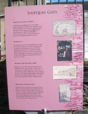
Shipquay Gate
'A city fit for war and merchandise'
In 1600 Elizabeth I of England instructed Sir Henry Docwra to establish and fortify a new settlement on the Foyle. An explosion in the cathedral in 1567 had largely destroyed the town. Docwra and his 4200 troops re-used the stones and rubbish of the old buildings. He surrounded the main fort with earthen walls to protect it from attack by powerful local chiefs.
Plantation city
The Plantation city was the first planned town in Ireland. The merchant companies of the City of London funded its building in return for grants of land in the North of Ireland. Four streets met in a central market area called the Diamond. Walls and ditches surrounded the settlement and a gate on each side controlled who went in and out. By 1620 the town had around 100 houses, a church and a school.
'Excellently made and neatly wrought'
Built between 1614-18 the walls are among the finest fortifications of their kind in Europe. They are over 1.5 km long and up to eight metres high: in places they are over nine metres wide. Originally there were four gates in the walls, two of which had drawbridges. Except along the steep slope overlooking the bog, a dry ditch, 3.5 metre deep, was dug outside the walls for added protection.
Abbey Street to Workhouse Lane
Street names are a reminder of the city's past. Vessels tied up at the foot of Shipquay Street until the late 18th century. A small boat took passengers across the river from the Ferryquay or Wapping. It became Bridge Street after the first crossing of the Foyle opened in 1781. Some names changed several times over the years - Ferryquay Street has also been known as Gracechurch Street, Gracious Street and Queen Street.
Topics. This historical marker is listed in these topic lists: Forts and Castles • Man-Made Features • Settlements & Settlers • Waterways & Vessels. A significant historical year for this entry is 1600.
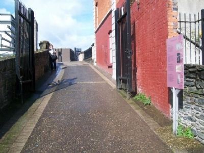
Location. 54° 59.808′ N, 7° 19.168′ W. Marker is in Derry-Londonderry, Northern Ireland, in Derry And Strabane. Marker is on the City Wall walking path, about 30 meters southeast of Shipquay Gate. Touch for map. Marker is at or near this postal address: 3 Bank Place, Derry-Londonderry, Northern Ireland BT48 6EA, United Kingdom. Touch for directions.
Other nearby markers. At least 8 other markers are within walking distance of this marker. Arthur Joyce Lunel Cary (a few steps from this marker); a different marker also named Shipquay Gate (within shouting distance of this marker); The Walled City (within shouting distance of this marker); … Free, entire and perfect (within shouting distance of this marker); Guildhall Square (within shouting distance
of this marker); War Memorial (within shouting distance of this marker); Demi-culverin Cannon (within shouting distance of this marker); a different marker also named Demi-culverin Cannon (within shouting distance of this marker). Touch for a list and map of all markers in Derry-Londonderry.
Also see . . . The Siege of Derry (1689). (Submitted on January 4, 2014, by William Fischer, Jr. of Scranton, Pennsylvania.)
Credits. This page was last revised on August 27, 2020. It was originally submitted on January 4, 2014, by William Fischer, Jr. of Scranton, Pennsylvania. This page has been viewed 387 times since then and 8 times this year. Photos: 1, 2. submitted on January 4, 2014, by William Fischer, Jr. of Scranton, Pennsylvania.

