Near Fairfax in Nicollet County, Minnesota — The American Midwest (Upper Plains)
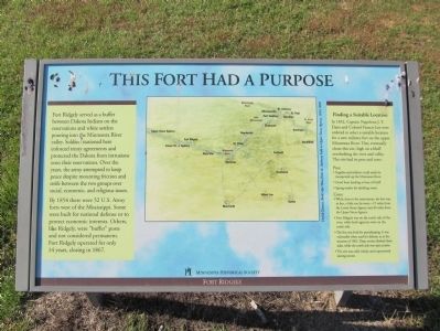
This Fort Had a Purpose
Fort Ridgely served as a buffer between Dakota Indians on the reservations and white settlers pouring into the Minnesota River valley. Soldiers stationed here enforced treaty agreements and protected the Dakota from intrusions onto their reservations. Over the years, the army attempted to keep peace despite mounting friction and strife between the two groups over social, economic, and religious issues.
By 1854 there were 52 U.S. Army forts west of the Mississippi. Some were built for national defense or to protect economic interests. Others, like Ridgely, were "buffer" posts and not considered permanent. Fort Ridgely operated for only 14 years, closing in 1867.
Finding a Suitable Location
In 1852, Captain Napoleon J.T. Dana and Colonel Francis Lee were ordered to select a suitable location for a new military fort on the upper Minnesota River. They eventually chose this site, high on a bluff overlooking the river and valley. The site had its pros and cons:
Pros:
• Supplies and soldiers could easily be transported up the Minnesota River.
• Good boat landing at base of bluff.
• Spring nearby for drinking water.
Cons:
• While close to the reservations, the fort was, in fact, a little too far away—15 miles from the Lower Sioux Agency and 40 miles from the Upper Sioux Agency.
• Fort Ridgely was on the north side of the river, while both agencies were on the south side.
• The fort was built for peacekeeping. It was vulnerable when used for defense, as in the summer of 1862. Deep ravines flanked three sides, while the north side was open prairie.
• The site was cold, windy, and unprotected during winter.
Fort Ridgely
Erected by the Minnesota Historical Society.
Topics and series. This historical marker is listed in these topic lists: Forts and Castles • Native Americans • Settlements & Settlers • Wars, US Indian. In addition, it is included in the Minnesota Historical Society series list. A significant historical year for this entry is 1854.
Location. 44° 27.191′ N, 94° 44.1′ W. Marker is near Fairfax, Minnesota, in Nicollet County. Marker can be reached from County Highway 30, 1.1 miles west of State Highway 4, on the right when traveling west. Marker is in Fort Ridgely State Park; fee area – a Minnesota state park vehicle permit is required. Touch for map. Marker is at or near this postal address: 72404 County State Aid Highway 30, Fairfax MN 55332, United States of America. Touch for directions.
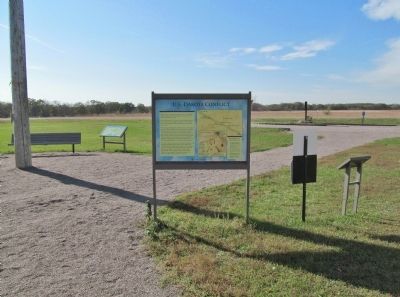
Other nearby markers. At least 8 other markers are within walking distance of this marker. Economic Engine (here, next to this marker); Four Days From Fort Snelling
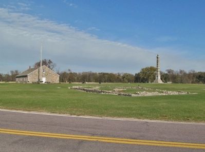
(a few steps from this marker); A Minority in Their Homeland / U.S.-Dakota Conflict (a few steps from this marker); Fort Ridgely (a few steps from this marker); Reinforcements Arrive (within shouting distance of this marker); Fort Ridgely Closes (within shouting distance of this marker); Officers' Quarters—C (within shouting distance of this marker); Fort Ridgely State Monument (within shouting distance of this marker). Touch for a list and map of all markers in Fairfax.
More about this marker. caption:
David Geister, Bird's-Eye View from St. Anthony Falls to Upper Sioux Agency, 1854, 2005
Also see . . . Fort Ridgely. Minnesota Historical Society website entry (Submitted on January 10, 2014.)
Additional keywords. U.S.-Dakota War of 1862
Credits. This page was last revised on June 2, 2023. It was originally submitted on January 10, 2014, by Keith L of Wisconsin Rapids, Wisconsin. This page has been viewed 456 times since then and 10 times this year. Photos: 1, 2, 3. submitted on January 10, 2014, by Keith L of Wisconsin Rapids, Wisconsin.


