Granite Falls in Yellow Medicine County, Minnesota — The American Midwest (Upper Plains)
Ancient Exposed Rocks
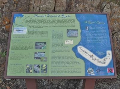
About 13,000 years ago, glacial melt water that collected in a basin named Glacial Lake Agassiz burst through a natural earthen dike creating a huge torrent of water that carved the Minnesota River Valley as we see it today. There are places along the valley where the scouring force of this tremendous ancient river, named the Glacial River Warren, tore the earth so deeply that 3.6 billion year-old metamorphic gneiss bedrock become exposed. These gneiss outcrops are scattered all along the valley floor from Ortonville to Mankato and today harbor some very unique plant and animal communities that strive to exist in a harsh environment.
Glacial River Warren
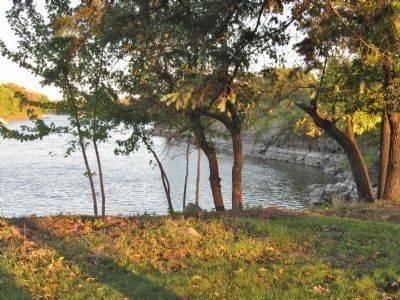
The Glacial River Warren was not the first to flow this path, but the sheer volume of this ancient river carved a footprint upon this land that is recognizable from satellite images. The ancient Glacial River Warren valley reaches almost two miles wide in places and 130 feet deep in others. Today, the slow and usually peaceful Minnesota River remains as it winds its way through exposed bedrock knobs of ancient gneiss and stretches from Browns Valley to the river's confluence with the Mississippi River at Fort Snelling in Mendota, Minnesota.
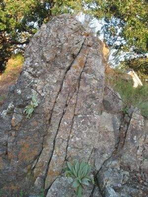
Some of the oldest exposed rocks known on earth can be found in the Minnesota River valley. Geologists estimate the earth to be 4.5 billion years old, and some of the exposed bedrock in this part of the Minnesota River valley was created over three billion years ago during the Precambrian Era. Here in Memorial Park, throughout the city of Granite Falls, and nearby in the Blue Devil Valley Scientific and Natural Area, outcrops of 3.6 billion year old rock called gneiss (pronounced "nice") can be seen.
Gneiss is a banded metamorphic rock formed when granite and other rocks were subjected to intense heat and pressure deep beneath the earth's surface for long periods of time. The word "gneiss" comes from an old Saxon mining term that seems to have meant decayed, rotten, or possibly worthless material. While identifying gneiss from other rocks can be difficult, rocks in the upper part of the Minnesota River Valley showing minerals occurring in distinct bands are probably gneiss.
The rocks in this area are some of the oldest known exposed rock in North America. The only bedrock in the world currently known to be older than the bedrock in the Minnesota River Valley is bedrock that has only recently been identified in Greenland.
Five-lined Skink
The gneiss rock outcroppings here and throughout Memorial Park provide rare habitat for unique plant and animal communities. The five-lined skink requires an environment of open
rock outcropping with nearby hardwood communities. The area in and around Memorial Park is one of the few places in Minnesota where this small reptile is found. Encroaching woody vegetation is limiting the skink's habitat today and may eventually eliminate this reptile from this site.
Lichen
Lichen are true pioneers. Lichen live in some of the most barren and inhospitable places. Lichen are a symbioses of two organisms, a fungus and algae. They are joined so completely that they behave and look like an entirely new being. Lichen can dissolve rock surfaces, begin the process of making soil, survive severe cold, and remain dormant for long periods without harm.
Cactus in Minnesota?
On the ancient gneiss outcroppings here in the Minnesota River Valley, three species of cactus have thrived for hundreds of years: the Plains Prickly Pear Cactus, the Brittle Prickly Pear Cactus and the Ball Cactus. The cactus's brief blooming time is in middle to late June.
A River's Legacy
From the Minnesota River's beginnings in the plains to its confluence into the Mississippi River, the river and its valley tell interesting tales of the ancient history and rich ecological diversity of the Upper Midwest. This is an important story to tell, as it is part of the overall effort to restore the Minnesota River and to connect people to the river and their own local environment.
Funded in part by Federal Highway Administration
logos of: America's Byways; City of Granite Falls; Scenic Byway Minnesota River Valley
www.mnrivervalley.com
(partially unreadable due to truncation)
Topics. This historical marker is listed in this topic list: Natural Features.
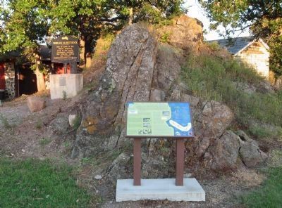
Location. 44° 48.197′ N, 95° 32.776′ W. Marker is in Granite Falls, Minnesota, in Yellow Medicine County. Marker can be reached from State Highway 67 east of State Highway 23, on the left when traveling east. Marker is by the Yellow Medicine County Historical Society Museum. Touch for map. Marker is at or near this postal address: 98 Minnesota State Highway 67 East, Granite Falls MN 56241, United States of America. Touch for directions.
Other nearby markers. At least 8 other markers are within 7 miles of this marker, measured as the crow flies. World's Oldest Rock (a few steps from this marker); Henry Hill 1829-1879 (within shouting distance of this marker); The Andrew J. Volstead House (approx. half a mile away); a different marker also named Andrew J. Volstead House (approx. half a mile away); Votes for Women (approx. half a mile away); Former Site of the Granite Falls City Hall (approx. 0.6 miles away); A Witness to Time (approx. 1.9 miles away); Yellow Medicine City (approx. 6˝ miles away). Touch for a list and map of all markers in Granite Falls.
More about this marker. photo captions:
• John J. Mosesso, NBII (National Biological Information Infrastructure)
• Ancient Gneiss Bedrock
• Plains Prickly Pear Cactus
• Ball Cactus
• Brittle Prickly Pear Cactus
Also see . . . Geology of Minnesota. Wikipedia entry. (Submitted on January 17, 2014.)
Credits. This page was last revised on August 6, 2021. It was originally submitted on January 17, 2014, by Keith L of Wisconsin Rapids, Wisconsin. This page has been viewed 745 times since then and 30 times this year. Photos: 1, 2, 3, 4. submitted on January 17, 2014, by Keith L of Wisconsin Rapids, Wisconsin.


