Peralta Hacienda in Oakland in Alameda County, California — The American West (Pacific Coastal)
Anza Expedition of 1776
La Expedición de Anza de 1776

Photographed By Barry Swackhamer, January 9, 2014
1. Anza Expedition of 1776 Marker (English)
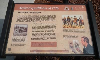
Captions: Historians believe this photo shows the site’s now vanished 1821 adobe. You can see where this small house of clay bricks once stood in the park’s Historic Core. Photo from The Story of Rancho San Antonio, Daisy Williamson de Veer, The background shows the original hand-drawn map of the Peraltas’ Rancho San Antonio. Courtesy of the Bancroft Library. (bottom left); This image, entitled “Landowner and Foreman” (Hacendero y mayordomo), illustrates the dress and postures of distinct social classes in California during the rancho era. Californio landowners and a foreman (far right) painted by Carl Nebel, published in Voyage pittoreque et archéolgique dans la partie la plus intéressante du Méxique, 1836. (top right); Antonio Peralta descendant Ken Talken with photos of his great-great-grandfather Antonio Peralta Jr. and Peralta Jr.’s sons, who once lived in the later 1840 adobe, and Ken’s great-great-grandmother Toñita Peralta. (bottom right).
The Peralta Family Legacy
Luis Maria Peralta was just 17 when he and his family set off for the Bay Area in September 1775m from the town of Tubac, Mexico (then in New Spain, now in Arizona near the Mexican border). His family joined other military families on an expedition sent north to strengthen Spain’s claim to Upper California, under the command of Juan Bautista de Anza. The group included people of American Indian, Spanish, African, and mestizo origin. A scouting party passed just east of this park location on March 31, 1776.
In 1820, shortly before Mexican Independence from Spain, Luis received a grant of 44,800 acres of East Bay land. To establish the claim, Peralta family members and Native American laborers constructed an adobe house where the park is today. Peralta’s house was the first non-Indian dwelling in the Oakland area.
Here on the land where seven modern cities now stand, they built up a cattle ranch with a workforce of local Indians and Mexicans like themselves, but who did not own land. Many people lived here and felt a bond to the land, both intimate and profound.
Visit the Peralta House Museum of History and Community to learn the stories of the Peraltas, and many others in this history, and to see historic objects and touchable replicas. Tour hours posted at the door.
Spanish:
Luis María Peralta tenía apenas 17 años en Septiembre 1755 cuando, junto con su familia, salió del pueblo de Tubac (entonces en Nueva España, luego en México, y hoy en Arizona cerca de la frontera) con rumbo a la Bahía de San Francisco. Los Peralta, junto con otras familias de militares, formaban parte de la expedición al mando de Juan Bautista de Anza, enviada para poblar a Alta California con súbditos españoles. Estos pobladores eran de origen indígena, europeo, y africano, y en muchos de ellos corría la sangre de dos or tres razas. Una avanzada del grupo pasó justo al este de este sitio el 31 de Marzo de 1776.
En 1820, poco antes de la independencia de México, Luis María recibió la concesión de 44,8000 acres de tierra al Este de La Bahía. Para tomar posesión, miembros de la familia con ayuda de indígenas de la zona, construyeron una casa de adobe en lo que hoy es el parque. La casa de los Peralta fue la primera residencia foránea en el actual Oakland.
En esta misma zona donde hoy existen siete

Photographed By Barry Swackhamer, January 9, 2014
2. Anza Expedition of 1776 Marker (Spanish)
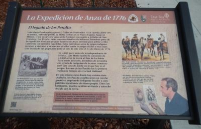
Captions: Los historiadores creen que esta foto muestra la casa de adobe de 1821 ya desparecida. Se puede visitar el sitio donde estuvo en el Centro Histórico del parque. La foto proviene de La historia del Rancho San Antonio, de Daisy Williamson de Veer.
El fondo muestra el mapa original dibujado a mano del Rancho San Antonio, de los Peralta. Con permiso de la Biblioteca Bancroft de la Universidad de California Berkeley.
Esta imagen titulada “Hacendero y mayordomo”, muestra la diferencia de vestido y posición entre las clases sociales de California en la época de los ranchos, propietarios californios y un mayordomo (a la derecha), pintado por Carl Nebel y publicado en Viaje pintoresco y arqueológico en la parte más interesante de México, 1836.
Ken Talken, descendiente de Antonio Peralta, con una foto de su tatarabuelo, Antonio Peralta Jr., con sus hijos, que por los 1840 vivieron en la casa de adobe, y una foto de su bisabuela, Toñita Peralta.
Visite el Museo de Historia de la Comunidad en la Casa de Peralta para conocer la historia de esta familia y otras, ver objetos de la época, y palpar reproducciones de piezas históricas. Horario de visitas guiadas en la puerta.
Bienvenidos al país de los Jalquin/Yrgin, una tribu Ohlone/Bahía, de lengua Miwok.
Erected 2011 by East Bay Regional Park District.
Topics. This historical marker is listed in these topic lists: Exploration • Settlements & Settlers. A significant historical date for this entry is March 31, 1776.
Location. 37° 47.234′ N, 122° 13.043′ W. Marker is in Oakland, California, in Alameda County. It is in Peralta Hacienda. Marker is on 34th Avenue near Hyde Street, on the left when traveling north. Touch for map. Marker is at or near this postal address: 2465 34th Avenue, Oakland CA 94601, United States of America. Touch for directions.
Other nearby markers. At least 8 other markers are within 2 miles of this marker, measured as the crow flies. Peralta Hacienda (a few steps from this marker); California Cotton Mill (approx. 1.2 miles away); Tidal Canal (approx. 1.4 miles away); Ky Eybright Boathouse (approx. 1.4 miles away); Cryer & Sons (approx. 1½ miles away); Sígame/Follow Me (approx. 1½ miles away); Union Point (approx. 1½ miles away); Water & Rails / Brooklyn Basin (approx. 1.6 miles away). Touch for a list and map of all markers in Oakland.
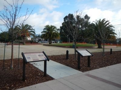
More about this marker. This marker is located in Peralta Hacienda Historical Park, to the north of the hacienda.
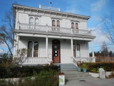
Also see . . . Peralat Family History - Peralta Hacienda Historical Park. The Peralta Hacienda Historical Park is one of the most significant historical sites in the East Bay. It was the first European settlement after the establishment of Mission San Jose and as such is the birthplace of Oakland. The focal point of the park is the 1870 Italianate Victorian farmhouse known as the Peralta House. A city and state landmark, the house is also listed on the National Register of Historic Places. (Submitted on January 18, 2014, by Barry Swackhamer of Brentwood, California.)
Additional keywords. De Anza Expedition
Credits. This page was last revised on February 7, 2023. It was originally submitted on January 18, 2014, by Barry Swackhamer of Brentwood, California. This page has been viewed 556 times since then and 13 times this year. Photos: 1, 2, 3, 4. submitted on January 18, 2014, by Barry Swackhamer of Brentwood, California. • Bill Pfingsten was the editor who published this page.

