Washington Addition in Jackson in Hinds County, Mississippi — The American South (East South Central)
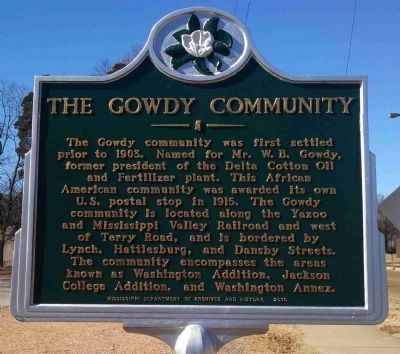
The Gowdy Community
Erected 2010 by Mississippi Department of Archives and History.
Topics and series. This historical marker is listed in these topic lists: African Americans • Communications • Industry & Commerce • Settlements & Settlers. In addition, it is included in the Mississippi State Historical Marker Program, and the Postal Mail and Philately series lists. A significant historical year for this entry is 1903.
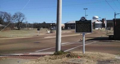
Location. 32° 17.848′ N, 90° 12.959′ W. Marker is in Jackson, Mississippi, in Hinds County. It is in Washington Addition. Marker is at the intersection of John R. Lynch Street and Valley Street, on the right when traveling east on John R. Lynch Street. Touch for map. Marker is at or near this postal address: 1201 Valley Street, Jackson MS 39203, United States of America. Touch for directions.
Other nearby markers. At least 8 other markers are within walking distance of this marker. Bobby Rush (within shouting distance of this marker); Jackson State Tragedy (approx. ¼ mile away); Dorothy Moore (approx. 0.3 miles away); Margaret Walker (approx. half a mile away); a different marker also named Jackson State Tragedy (approx. half a mile away); A Bench By The Road (approx. half a mile away); Ishmon Bracey (approx. half a mile away); Greater Mt. Calvary Chapel (approx. 0.7 miles away). Touch for a list and map of all markers in Jackson.
Also see . . .
1. Mississippi Digital Library: Inventory of the Gowdy Oral History Collection. (Submitted on January 19, 2014, by Cleo Robertson of Fort Lauderdale, Florida.)
2. From Gowdy to Washington Addition and Beyond (pdf file). "From Gowdy to Washington Addition and Beyond: History and the JSU led Redevelopment Efforts" by Garrad Lee, Master’s Degree Candidate, Department of History Jackson State University. (Submitted on January 19, 2014, by Cleo Robertson of Fort Lauderdale, Florida.)
Additional commentary.
1. Origin of Gowdy
The community that was once known as Gowdy was formed by black settlers in the early 20th century and is located near Jackson State University in the Washington Addition neighborhood. Gowdy was laid out in a square and its streets were named for black leaders
and U.S. presidents. Many early residents were skilled in carpentry, masonry, music, nursing and teaching. In fact, many of Jackson State's early faculty members and students lived in Gowdy.
— Submitted January 19, 2014, by Cleo Robertson of Fort Lauderdale, Florida.

Photographed By Cleo Robertson
3. The Gowdy Community Aerial Map
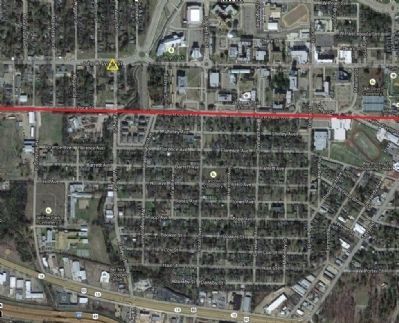
Area of the Gowdy Community, with the portion of the Yazoo & Mississippi Valley Railroad, incorporated February 17, 1882, shown by the red line. The Y&MV RR operated as part of the Illinois Central until it was officially merged into the IC in 1946. Marker location is shown by the yellow triangle.
Credits. This page was last revised on February 16, 2023. It was originally submitted on January 19, 2014, by Cleo Robertson of Fort Lauderdale, Florida. This page has been viewed 952 times since then and 61 times this year. Photos: 1, 2, 3. submitted on January 19, 2014, by Cleo Robertson of Fort Lauderdale, Florida. • Bernard Fisher was the editor who published this page.

