Danbury in Fairfield County, Connecticut — The American Northeast (New England)
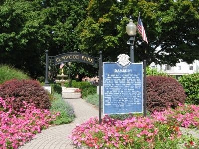
Elmwood Park
Danbury, Connecticut
— The Museum in the Streets® —
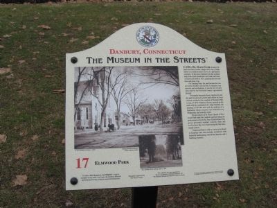
In 1801, Mr. Major Starr donated the land necessary to take a large curve out of Main Street on condition that it serve as a permanent common. To this end, residents from the southern end of the street raised their own funds and created Elmwood Park in 1853, planting the first elm trees and a hay crop.
On Training Days, the park became the center for the Artillery and Cavalry Companies’ maneuvers and celebrations. It was the site of early fairs held by the Fairfield County Agricultural Society.
Eventually the pretty fence rotted away and the park became an eyesore until efforts by local citizens resulted in the creation of Fountain Park in July of 1879. Danbury citizens spruced up the park with the installation of a large fountain, the planting of 60 elm trees and the addition of a bandstand where concerts were featured every Wednesday and Saturday night.
The proximity of St. Peter Church to Elmwood Park made the location a perfect setting for performances by the St. Peter Church Band. The group presented summer concerts there and evolved into the town band during the late nineteenth century.
Elmwood Park is still an oasis in the heart of Danbury and was recently revitalized with beautiful landscaping, welcoming benches and a bubbling fountain.
Erected by The Museum in the Streets®. (Marker Number 17.)
Topics and series. This historical marker is listed in these topic lists: Agriculture • Charity & Public Work • Parks & Recreational Areas. In addition, it is included in the The Museum in the Streets®: Danbury, Connecticut series list. A significant historical month for this entry is July 1879.
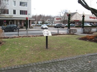
Location. 41° 23.494′ N, 73° 26.945′ W. Marker is in Danbury, Connecticut, in Fairfield County. Marker is at the intersection of Main Street and Boughton Street, on the left when traveling south on Main Street. Located in Elmwood Park. Touch for map. Marker is in this post office area: Danbury CT 06810, United States of America. Touch for directions.
Other nearby markers. At least 8 other markers are within walking distance of this marker. Schools and Education (within shouting distance of this marker); Danbury (about 400 feet away, measured in a direct line); The Danbury Court House (about 400 feet away); The Circus Comes to Town (about 500 feet away); Oldest Cemetery 1684 (about 500 feet away); The Danbury Raid (about 500 feet away); Danbury 9-11 Memorial (about 600 feet away); Industrial Strength Danbury (about 700 feet away). Touch for a list and map of all markers in Danbury.
Credits. This page was last revised on November 25, 2021. It was originally submitted on January 25, 2014, by Michael Herrick of Southbury, Connecticut. This page has been viewed 819 times since then and 30 times this year. Photos: 1, 2. submitted on January 25, 2014, by Michael Herrick of Southbury, Connecticut. 3. submitted on September 29, 2009, by Michael Herrick of Southbury, Connecticut.


