Near Shell in Big Horn County, Wyoming — The American West (Mountains)
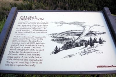
Nature's Destruction
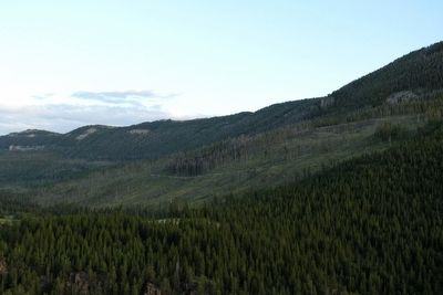
While tornadoes usually occur on the plains, several have visited the Big Horn Mountains. Blowing down mountain timber at 10,000 feet above sea level, these tornadoes are among the highest on record. The Forest Service salvaged part of the downed timber, but the steepness made it difficult to retrieve trees from the upper slopes. A road at the bottom of the blowdown area enabled some clearing and reseeding. Most of the scar has revegetated naturally.
Erected by Bighorn National Forest.
Topics. This historical marker is listed in these topic lists: Environment • Horticulture & Forestry. A significant historical month for this entry is June 1959.
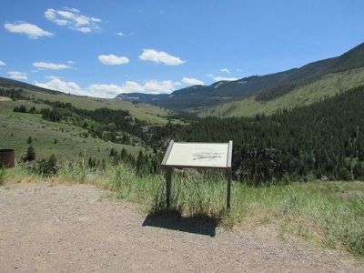
Location. 44° 34.346′ N, 107° 33.048′ W. Marker is near Shell, Wyoming, in Big Horn County. Marker is on U.S. 14, one mile west of Forest Road 17, on the right when traveling west. Marker is located along the Bighorn Scenic Byway approximately 13 miles east of Shell. Touch for map. Marker is in this post office area: Shell WY 82441, United States of America. Touch for directions.
Other nearby markers. At least 8 other markers are within 4 miles of this marker, measured as the crow flies. Agents of Change (here, next to this marker); Wringing Out a Livelihood (approx. 3.3 miles away); Moving Mountains (approx. 3.3 miles away); A 4,000 Mile Journey (approx. 3.3 miles away); Forming Waterfalls (approx. 3.3 miles away); Hummingbirds (approx. 3.3 miles away); Shaping a Canyon (approx. 3.3 miles away); Lifeblood of the West (approx. 3.3 miles away). Touch for a list and map of all markers in Shell.
More about this marker. The illustrative drawing on the marker was done by Connie J. Robinson in 1989.
Credits. This page was last revised on June 16, 2016. It was originally submitted on January 28, 2014, by Duane Hall of Abilene, Texas. This page has been viewed 642 times since then and 25 times this year. Photos: 1. submitted on January 28, 2014, by Duane Hall of Abilene, Texas. 2. submitted on September 4, 2015, by Bill Coughlin of Woodland Park, New Jersey. 3. submitted on January 28, 2014, by Duane Hall of Abilene, Texas.


