Near Morton in Renville County, Minnesota — The American Midwest (Upper Plains)
Battle Tactics
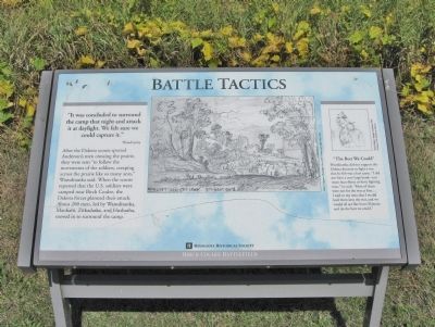
"It was concluded to surround the camp that night and attack it at daylight. We felt sure we could capture it."
After the Dakota scouts spotted Anderson's men crossing the prairie, they were sent "to follow the movements of the soldiers, creeping across the prairie like so many ants," Wamditanka said. When the scouts reported that the U.S. soldiers were camped near Birch Coulee, the Dakota forces planned their attack. About 200 men, led by Wamditanka, Mankato, Zitkadaska, and Hushasha, moved in to surround the camp.
The Best We Could
Wamditanka did not support the Dakota decision to fight a war that he felt was a lost cause. "I did not have a very large band—not more than thirty or forty fighting men," he said. "Most of them were not for the war at first.... I said to my men that I would lead them into the war and we would all act like brave Dakotas and do the best we could."
Birch Coulee Battlefield
Erected by the Minnesota Historical Society.
Topics and series. This historical marker is listed in this topic list: Wars, US Indian . In addition, it is included in the Minnesota Historical Society series list.
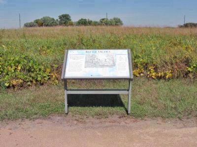
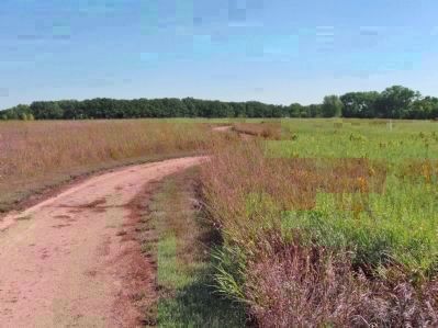
Location. 44° 34.546′ N, 94° 58.667′ W. Marker is near Morton, Minnesota, in Renville County. Marker can be reached from County Road 18, 0.2 miles south of 690th Avenue (County Road 2), on the left when traveling south. Marker is within Birch Coulee Battlefield/State Park. Touch for map. Marker is at or near this postal address: 68634 County Road 18, Morton MN 56270, United States of America. Touch for directions.
Other nearby markers. At least 8 other markers are within walking distance of this marker. Wrong Place, Wrong Time (about 300 feet away, measured in a direct line); "A Beautiful Place to Encamp" (about 300 feet away); Two Men, One War (about 400 feet away); Dakota Positions (about 400 feet away); Battle Scars (about 400 feet away); “The Fight Was On” (about 500 feet away); The Prairie Factor (about 500 feet away); The Battle of Birch Coulee (about 600 feet away). Touch for a list and map of all markers in Morton.
More about this marker. captions:
• Albert Colgrave, Moonlight View of the Camp, 2nd Night Out, 1862
• Frank Mayer, Kangbr-madokah, 1851 Courtesy The Newberry Library
Regarding Battle Tactics. In 1862, the Minnesota Dakota, also known
by the French term, “Sioux," waged war against the United States following two years of unfulfilled treaty obligations. A burial detail of 160 to 170 soldiers and civilians was dispatched from Fort Ridgely to bury the remains of settlers who had been killed in the early weeks of the war. During the first night out, the detail was surrounded by Dakota, who attacked at dawn.
Also see . . .
1. The Battle of Birch Coulee. Minnesota Historical Society. (Submitted on January 29, 2014.)
2. July 1, 1894: Chief Big Eagle speaks. Star Tribune article, interview with Chief Big Eagle (Wamditanka). Birch Coulie. "Nearly all the Indians had double-barreled shotguns, and we loaded them with buckshot and large bullets... Both sides fought well. Owing to the white men's way of fighting they lost many men. Owing to the Indians' way of fighting they lost but few." (Submitted on January 29, 2014.)
Additional keywords. U.S.-Dakota War of 1862
Credits. This page was last revised on June 16, 2016. It was originally submitted on January 29, 2014, by Keith L of Wisconsin Rapids, Wisconsin. This page has been viewed 607 times since then and 41 times this year. Photos: 1, 2, 3. submitted on January 29, 2014, by Keith L of Wisconsin Rapids, Wisconsin.


