Near Dayville in Grant County, Oregon — The American West (Northwest)
Picture Gorge Basalts
John Day Fossil Beds National Monument
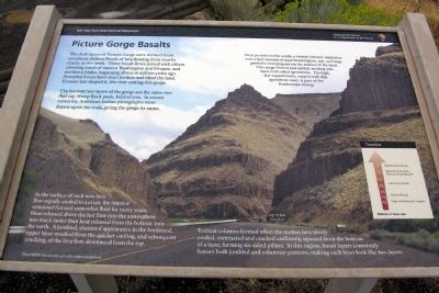
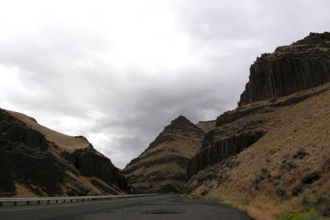
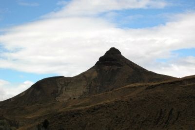
The bottom two layers of the gorge are the same two that cap Sheep Rock peak, behind you. In recent centuries, American Indian pictographs were drawn upon the rock, giving the gorge its name.
As the surface of each new lava flow rapidly cooled to a crust, the interior remained hot and somewhat fluid for many years. Heat released above the hot flow into the atmosphere was much faster than heat released from the bottom into the earth. A jumbled, shattered appearance in the hardened, upper layer resulted from the quicker cooling, and subsequent cracking of the lava flow downward from the top.
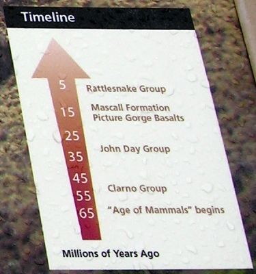
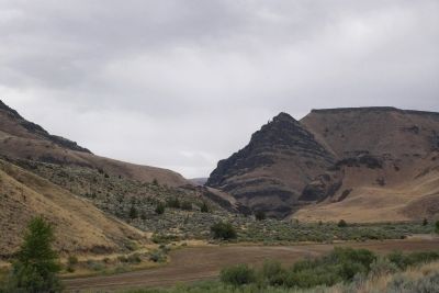
Over 70 miles to the south, a violent volcanic explosion sent a fiery torrent of superheated gases, ash, and large particles sweeping across the surface of the land. This surge slowed and settled, welding into hard rock called ignimbrite. The high, flat-topped mesa, capped with his ignimbrite layers, is part of the Rattlesnake Group.
Vertical columns formed when the molten lave slowly cooled, contracted and cracked uniformly, upward from the bottom of the layer, forming six-sided pillars. In this region, basalt layers commonly feature both jumbled and columnar patterns, making each layer look like two layers.
Erected by National Park Service.
Topics. This historical marker is listed in this topic list: Natural Features.
Location. 44° 31.873′ N, 119° 38.122′ W. Marker is near Dayville, Oregon, in Grant County. Marker is on Oregon Route 19, 0.2 miles north of U.S. 26, on the left when traveling north. Marker is just north of the southern entrance into the Sheep Rock Unit of John Day Fossil Beds National Monument. Touch for map. Marker is in this post office area: Dayville OR 97825, United States of America. Touch for directions.
Other nearby markers. At least 8 other markers are within 2 miles of this marker, measured as the crow flies. The Shearing Done (approx. 1.4 miles away); An Oregon Fossil Rush (approx. 1.6 miles away); On the Road of History (approx. 1.7 miles away); Lifeblood of a Ranch (approx. 1.7 miles away); James Cant Ranch Historic District (approx. 1.7 miles away); a different marker also named James Cant Ranch Historic District (approx. 1.7 miles away); Welcome to the John Day River (approx. 1.7 miles away); Haystacker (approx. 1.7 miles away). Touch for a list and map of all markers in Dayville.
More about this marker. The background photograph of the marker shows the marker itself and its relative location in the gorge.
Credits. This page was last revised on June 16, 2016. It was originally submitted on January 30, 2014, by Duane Hall of Abilene, Texas. This page has been viewed 753 times since then and 26 times this year. Photos: 1, 2, 3, 4, 5. submitted on January 30, 2014, by Duane Hall of Abilene, Texas.
Editor’s want-list for this marker. Photo of wide-view of marker. • Can you help?
