Near Hesperus in La Plata County, Colorado — The American Mountains (Southwest)
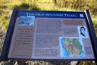
The Old Spanish Trail
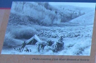
Dominguez and Escalante traveled through this valley in 1776. Within twenty-five years of their expedition this trail became a regional trade route between the Spanish outposts in what is now California and New Mexico. Under the watchful eye of the Spanish government and later the Mexican government, both legal and illegal traders ventured deep into the Great Basin to barter with the Ute Indians. Sheep and textiles from New Mexico were traded for mules and horses in southern California and brought back for use on the Santa Fe Trail – between Missouri and what is now New Mexico.
One prominent traveler on the trail was Antoine Robidoux. He used this snow-free route to supply Fort Uncompahgre which he located on the Gunnison River. Robidoux traded cotton, blankets, tobacco, tea, coffee, knives, liquor (“Taos Lightning,”) and an occasional rifle to the Ute Indians in exchange for deer skin clothes, beaver pelts, and castoreum – a beaver scent gland that was used to make perfume and medicine.
Slaves were also traded and moved along the Old Spanish Trail. Ute, Paiute, and Navajo Indians, as well as young Hispanic women were often illegally bartered and sold as slaves in colonial New Mexico.
(Upper Right Text Box)
“A company of sixty men left this territory for California with the purpose of trading for mules with the products of this country.... I believe that it would be greatly to the advantage of both territories to promote the commerce of this region.”
– New Mexico Governor, Jose Antonio Chavez, 14 May 1830, regarding Antonio Armijo expedition in 1829.
(Center Right Photo Caption)
Antoine Robidoux, a French Canadian, became a Mexican citizen and married the daughter of the Mexican Governor. Through marriage, he was granted the right to control trade in what would later be western Colorado and eastern Utah. In 1828, Robidoux established Fort Uncompahgre on the Gunnison River and Fort Uintah on the Green River.
– Painting of Antoine Robidoux in 1843. Painting courtesy of the Museum of New Mexico
(Lower Right Map Caption)
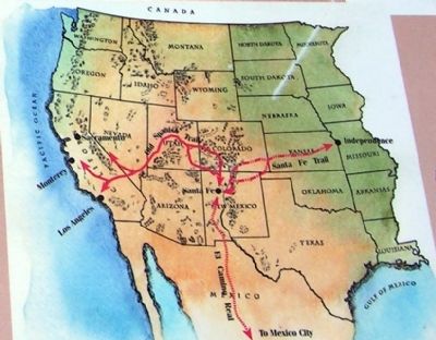
In the early 1800s, the Old Spanish Trail was entirely within Spanish Territory. Santa Fe became a trade center as it was the terminus for three trails in the southwest United States.
Erected by Old Spanish Trail Association (OSTA).
Topics and series. This historical marker is listed in these topic lists: Forts and Castles • Industry & Commerce • Roads & Vehicles. In addition, it is included in the Old Spanish National Trail series list. A significant historical date for this entry is May 14, 1830.
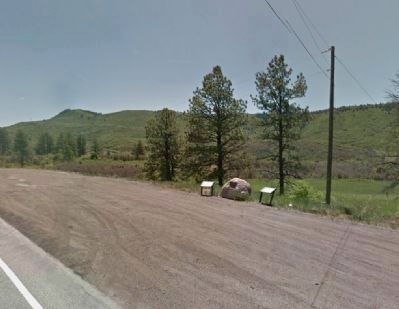
Location. 37° 19.54′ N, 108° 7.975′ W. Marker is near Hesperus, Colorado, in La Plata County. Marker is on U.S. 160, 0.8 miles west of Cherry Creek Road, on the left when traveling west. Touch for map. Marker is in this post office area: Hesperus CO 81326, United States of America. Touch for directions.
Other nearby markers. At least 8 other markers are within 9 miles of this marker, measured as the crow flies. Dominguez - Escalante Expedition (here, next to this marker); Dominguez & Escalante (here, next to this marker); [Old] Fort Lewis College (approx. 8 miles away); Cedar Grove Cemetery Veterans' Memorial (approx. 8.6 miles away); 1892 Horse-Drawn Pull Grader (approx. 8.7 miles away); Bauer House (approx. 8.7 miles away); The Columbine Bar (approx. 8.7 miles away); Mancos Opera House (approx. 8.7 miles away). Touch for a list and map of all markers in Hesperus.
More about this marker. Marker is an interpretive sign of the San Juan Skyway scenic highway.
Also see . . . Old Spanish Trail Association Official Website. (Submitted on February 6, 2014.)
Credits. This page was last revised on March 15, 2023. It was originally submitted on February 6, 2014, by Duane Hall of Abilene, Texas. This page has been viewed 1,143 times since then and 44 times this year. Last updated on March 15, 2023, by Jeff Wilson of North Springfield, Virginia. Photos: 1, 2, 3, 4. submitted on February 6, 2014, by Duane Hall of Abilene, Texas. • Bill Pfingsten was the editor who published this page.
Editor’s want-list for this marker. Photo of wide-view of markers and surroundings. • Can you help?


