Honolulu in Honolulu County, Hawaii — Hawaiian Island Archipelago (Pacific Ocean)
Pearl Harbor Panorama-West
USS Arizona Memorial
Inscription.
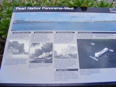
From this viewpoint along the eastern shore of Pearl Harbor you can see many features associated with the 1941 Japanese attack. The photo was taken in 1991, fifty years after the bombing.
1. Naval Station Signal Tower-From the top of this water tower the U.S. Navy directed vessels in and out of the harbor in 1941. The tower is still in use today.
(Inscription below the photo)
The Naval signal tower is the center one in this photo taken December 7, 1941, from the Marine Barracks parade ground. Smoke is from the burning USS Arizona.
2. Floating Drydock No. 2 (YFD21) In this section of the Naval Shipyard, harbor tug USS Sotoyomo and destroyer USS Shaw were in a floating dry dock for repairs when Japanese dive bombers struck. The dock and both ships were sunk.
(Inscription under the photo)
The forward magazine of destroyer USS Shaw explodes in Floating Drydock No. 2.
3. Ford Island Seaplane Base-Japanese dive bombers and fighters destroyed nearly 40 U.S. Navy aircraft on the ground at Ford Island, many of them seaplanes such as PBY’s used for long-range patrol and bombing. The PBY launching ramp was located here on the southern tip of the island.
(Inscription under the photo)
Against a curtain of smoke from burning ships, sailors begin clearing wreckage and repairing runways at the seaplane ramp just after the attack. The larger planes are Consolidated PBY’s.
4. Control Tower-The Naval Air Station control tower visible today was nearing completion in December 1941, and was already a prominent landmark. The runway was located down the center of the island.
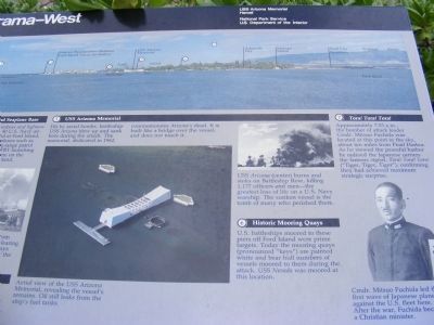
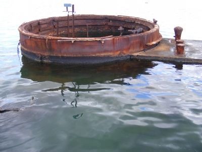
5. USS Arizona Memorial-Hit by aerial bombs, battleship USS Arizona blew up and sank here during the attack. The memorial, dedicated in 1962, commemorates Arizona’s dead. It is built like a bridge over the vessel, and does not touch it.
(Inscription under the photo)
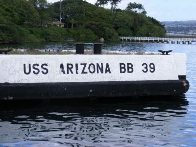
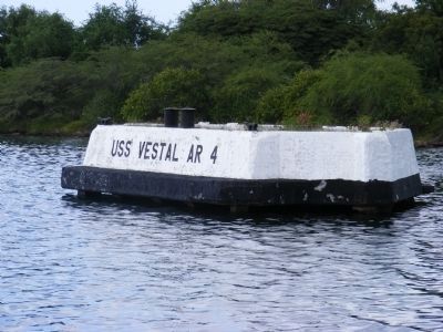
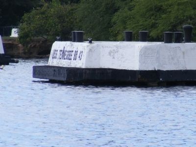
Aerial view of the USS Arizona Memorial, revealing the vessel’s remains. Oil still leaks from the ship’s fuel tanks (Inscription under the photo at the top) USS Arizona (center) burns, and sinks on Battleship Row, killing 1,177 officers and men---the greatest loss of life on a U.S. Navy warship. The sunken vessel is the tomb of many perished there. 6. Historic Mooring Quays-U.S. battleships moored to these piers off Ford Island were prime targets. Today the mooring quays (pronounced “keys”) are painted white and bear the hull numbers of vessels moored to them during the attack. USS Nevada was moored at his location.
7. Tora! Tora! Tora!-Approximately 7:53 a.m., the bomber attack leader Cmdr. Mitsuo Fuchida was located at his point in the sky, about ten miles from Pearl Harbor. As he viewed the peaceful harbor
he radioed the Japanese carriers the famous signal, Tora! Tora! Tora! “(Tiger, Tiger, Tiger”), confirming they had achieved maximum strategic surprise.
(Inscription under the photo)
Cmdr. Mitsuo Fuchida let the first wave of Japanese planes against the U.S. fleet here. After the war, Fuchida became a Christian minister.
Erected by National Park Service-United States Department of the Interior.
Topics. This memorial is listed in this topic list: War, World II.
Location. 21° 22.022′ N, 157° 56.39′ W. Marker is in Honolulu, Hawaii, in Honolulu County. Memorial is on Arizona Memorial Place. The marker is located on the Ceremonial Lawn of the USS Arizona Memorial which is a unit of the World War II Valor in the Pacific National Monument. Touch for map. Marker is in this post office area: Honolulu HI 96818, United States of America. Touch for directions.
Other nearby markers. At least 8 other markers are within walking distance of this marker. Sunday Morning (here, next to this marker); Pearl Harbor Panorama-North (here, next to this marker); Bombers Over Battleship Row (a few steps from this marker); Island of Oahu (within shouting distance of this marker); Fall and Rise of the Fleet (within shouting distance of this marker); USS Arizona Anchor (about 300 feet away, measured in a direct line); The Lone Sailor (about 300 feet away); United States Marine Corps (about 400 feet away). Touch for a list and map of all markers in Honolulu.
Credits. This page was last revised on June 16, 2016. It was originally submitted on February 6, 2014, by Don Morfe of Baltimore, Maryland. This page has been viewed 722 times since then and 21 times this year. Photos: 1, 2, 3, 4, 5, 6. submitted on February 6, 2014, by Don Morfe of Baltimore, Maryland. • Bill Pfingsten was the editor who published this page.
