Bay-O-Vista in San Leandro in Alameda County, California — The American West (Pacific Coastal)
Lake Chabot Historical Walk
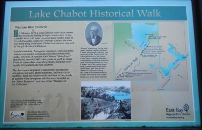
Welcome time travelers!
In February 1874 a large Chinese work force entered this woodland setting to begin construction of San Leandro Reservoir. Later renamed Lake Chabot after its French-Canadian originator Anthony Chabot, the dam was built using techniques Chabot learned and invented in the gold-fields of California.
Irish blacksmiths, Portuguese teamsters, and Caucasian masons and miners would also join the construction ranks. However, it was the 800 Chinese “shovel men” that moved over 600,000 cubic yards of earth to create Chabot’s dream dam. once the primary drinking water supply for Oakland and San Leandro.
The dam’s colorful past is a storyteller’s playground of engineering feats, ghost mansions, and mud-caked stallions. Take this history walk and look at the panels to explore what newspaper articles once heralded as the “Great Reservoir” and one of the “Wonders of the California.”
Captions:
Dubbed “Water King” by the local paper, amateur engineer Anthony Chabot was praised as having “not his equal on the Pacific Coast” for his establishment of the Contra Costa Water Company and other water systems in the San Francisco area. A former gold miner or “49er,” Chabot’s use of the canvas water hose, a predecessor to the water hose, gave him the title “Father of Hydraulic Mining.” His name is also immortalized at Chabot Observatory and Science Center, one of his many charities. (top center); “The Chinamen do the greater part of the hard heavy work, such as blasting, carting, laying pipes, etc.” San Leandro Record of Sept. 11, 1875. (bottom left); The Chinese hat, shovel, and pickaxe symbolize the Chinese contribution to the dam’s construction. (bottom left).
Erected 2012 by East Bay Regional Park District.
Topics. This historical marker is listed in these topic lists: Asian Americans • Industry & Commerce • Parks & Recreational Areas • Waterways & Vessels. A significant historical month for this entry is February 1874.
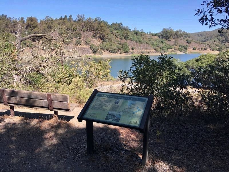
Location. 37° 43.911′ N, 122° 7.791′ W. Marker is in San Leandro, California, in Alameda County. It is in Bay-O-Vista. Marker can be reached from Estudillo Avenue, on the right when traveling east. Touch for map. Marker is at or near this postal address: 1799 Estudillo Avenue, San Leandro CA 94577, United States of America. Touch for directions.
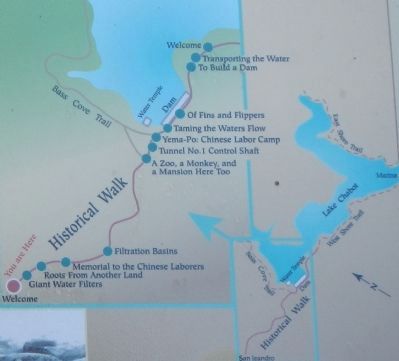
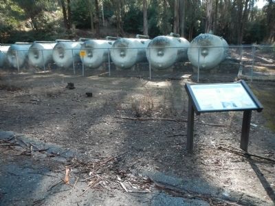
Other nearby markers. At least 8 other markers are within walking distance of this marker. Giant Water Filters (a few steps from this marker); Roots From Another Land (about 300 feet away, measured in a direct line); Memorial to the Chinese Laborers (about 600 feet away); Filtration Basins (about 700 feet away); A Zoo, a Monkey, and a Mansion Here Too! (approx. 0.3 miles away); Tunnel No. 1 Control Shaft (approx. 0.3 miles away); Yem-Po: Chinese Labor Camp (approx. 0.4 miles away); Taming the Waters’ Flow (approx. 0.4 miles away). Touch for a list and map of all markers in San Leandro.
More about this marker. The one mile Lake Chabot Historical Walk begins at the parking lot at the end of Estudillo Avenue. This marker is about 100 yards from the beginning of the trail.
Also see . . . Lake Chabot Regional Park. East Bay Regional Park District website entry:
The staff at Lake Chabot recently installed thirteen new historical panels that detail the story of mid-1800s "Water King" Anthony Chabot and the innovative creation and use of Lake Chabot as a water source through the 1970s. (Submitted on February 9, 2014, by Barry Swackhamer of Brentwood, California.)
Additional keywords. Engineering feats
Credits. This page was last revised on February 7, 2023. It was originally submitted on February 9, 2014, by Barry Swackhamer of Brentwood, California. This page has been viewed 1,091 times since then and 36 times this year. Photos: 1, 2, 3. submitted on February 9, 2014, by Barry Swackhamer of Brentwood, California. 4. submitted on October 14, 2021, by Craig Baker of Sylmar, California. • Bill Pfingsten was the editor who published this page.


