Near Winamac in Pulaski County, Indiana — The American Midwest (Great Lakes)
Indiana's Fire Towers
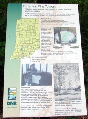
In 1930, Indiana began constructing a series of fire towers with the goal of having no visibility gap. By 1952, Indiana had 33 towers, most of them in the southern half of the state.
Tools of the Trade
Fire towers were generally equipped with:
Communication equipment (radio and telephone)
Psychrometer to measure humidity and determine fire danger
Alidade to determine the exact location of a fire.
Osborne Fire Finder: pinpointing a fire
An alidade, sometimes referred to as an Osborne Fire Finder, consisted of an oriented topographic map on a circular disk. Moveable sighting apertures were opposite each other on the disk. The fire lookout lined the apertures on a plume of smoke and determined the line on which the fire was located. Another fire tower lookout did the same process. The fire was located where their two lines crossed.
Fire Lookouts
Many Indiana lookouts were local farmers, recruited when the fire danger was high. Sometimes a wife or other family member would serve as lookout. Lookout duties included: watching for smoke, locating and reporting suspicious smoke plumes, taking weather readings, communicating with fire crews during a fire, recording fires, keeping the area around the tower mowed and keeping the outhouse clean.
Lookouts had to pass a vision test and be able to climb the tower several times. During WWII, many of Indiana’s lookouts were women.
By the 1970s, planes replaced fire towers as the means of locating fires. Today, fires are reported by local residents.
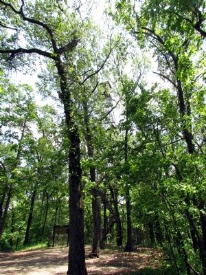
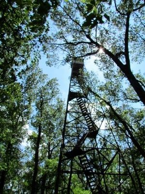
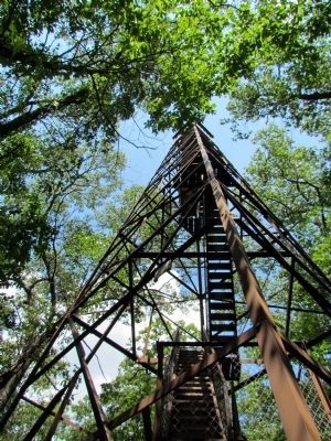
This fire tower stands as a sentinel, reminding us of the time when Indiana was protected by a series of towers staffed by dedicated lookouts.
Erected by Indiana Department of Natural Resources.
Topics. This historical marker is listed in these topic lists: Disasters • Horticulture & Forestry. A significant historical year for this entry is 1930.
Location. 41° 6.942′ N, 86° 35.632′ W. Marker is near Winamac, Indiana, in Pulaski County. Marker can be reached from Base Road North (U.S. 35) half a mile north of County Road 350N. Marker is located in Tippecanoe River State Park and adjacent to parking lot for fire tower trail; directions are to the park entrance. Touch for map. Marker is in this post office area: Winamac IN 46996, United States of America. Touch for directions.
Other nearby markers. At least 8 other markers are within 13 miles of this marker, measured as the crow flies. The Teacher (approx. 4˝ miles away); U.S. Civil War Honor Roll (approx. 4˝ miles away); Pulaski County Honor Roll Memorial (approx. 4˝ miles away); "Panhandle" Freight House (approx. 4˝ miles away); Frank H. Ono Memorial (approx. 11.7 miles away); Koffel Building (approx. 12.7 miles away); PFC Frank H. Ono (approx. 12.7 miles away); The 18 Pounder Long Gun (approx. 12.7 miles away). Touch for a list and map of all markers in Winamac.
Also see . . . Tippecanoe River State Park. Indiana Department of Natural Resources website with link to park map. (Submitted on February 10, 2014.)
Credits. This page was last revised on June 16, 2016. It was originally submitted on February 10, 2014, by Duane Hall of Abilene, Texas. This page has been viewed 983 times since then and 39 times this year. Photos: 1, 2, 3, 4, 5. submitted on February 10, 2014, by Duane Hall of Abilene, Texas.
Editor’s want-list for this marker. Photo of wide-view of marker and surroundings. • Can you help?
