Seaford in Sussex County, Delaware — The American Northeast (Mid-Atlantic)
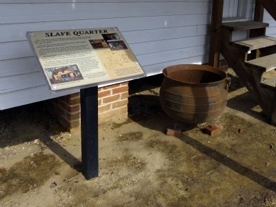
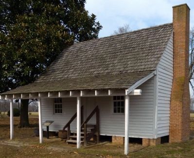
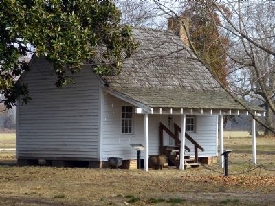
Slave Quarter
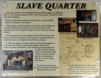
Governor Ross had as many as fourteen slaves. Some probably lived in the mansion or other barns.
Following the Civil War and the end of slavery, this building was relocated northeast of the mansion. In its new location on the property, the roof was raised to make a two story house for tenant farmers.
The Ross family owned the property until 1924 when they were forced to declare bankruptcy. As the property changed hands, the tenant farm was neglected and fell into disrepair.
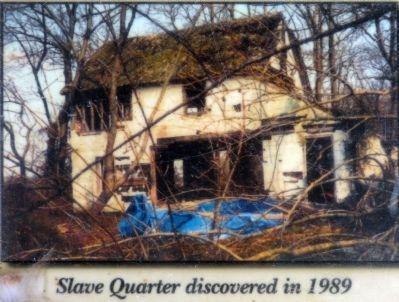
In 1989, the quarter was discovered by a great-great-grandson of Governor Ross while he explored the property then owned by the University of Delaware. The university president appointed an eight member research team to document the 19th century log structure that had been incorporated into the two story tenant house.
The University of Delaware donated the quarter to the Seaford Historical Society in 1992.
Erected by Seaford Historical Society.
Topics. This historical marker is listed in this topic list: African Americans. A significant historical year for this entry is 1924.
Location. 38° 39.434′ N, 75° 37.096′ W. Marker is in Seaford, Delaware, in Sussex County. Marker can be reached from Ross Station Road. on the grounds of the Ross Mansion at 23669 Ross Station Road. Touch for map. Marker is in this post office area: Seaford DE 19973, United States of America. Touch for directions.
Other nearby markers. At least 8 other markers are within one mile of this marker, measured as the crow flies. Family Home of William H. H. Ross (within shouting distance of this marker); Governor Ross Mansion (approx. 0.2 miles away); Seaford High School (approx. ¾ mile away); Seaford Hundred (approx. 0.8 miles away); Seaford Veterans Memorial (approx. 0.9 miles away); Veterans Memorial (approx. one mile away); St. John's United Methodist Church (approx. one mile away); Nanticoke Post No. 6 (approx. one mile away). Touch for a list and map of all markers in Seaford.
Also see . . . Ross Mansion Quarter. (PDF) Historic Structures Report, University of Delaware Ross Mansion Quarter Committee, July 1992. (Submitted on February 12, 2014, by Allen C. Browne of Silver Spring, Maryland.)
Photographed By Allen C. Browne, February 9, 2014
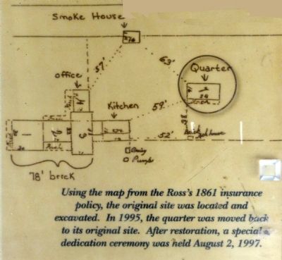
5. 1861 Insurance Map
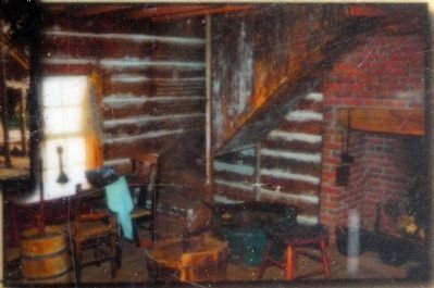
Using the map from the Ross's 1861 insurance policy, the original site was located and excavated. In 1995, the quarter was moved back to its original site . After restoration, a special dedication ceremony was held August 2, 1997. Close-up of map on marker
Credits. This page was last revised on June 16, 2016. It was originally submitted on February 12, 2014, by Allen C. Browne of Silver Spring, Maryland. This page has been viewed 561 times since then and 40 times this year. Photos: 1, 2, 3, 4, 5, 6, 7. submitted on February 12, 2014, by Allen C. Browne of Silver Spring, Maryland. • Bill Pfingsten was the editor who published this page.
