Near Joseph in Wallowa County, Oregon — The American West (Northwest)
Hells Canyon National Recreation Area
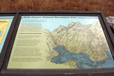
Hells Canyon National Recreation Area offers a variety of exceptional recreational opportunities. In addition, it is managed to conserve the scenic, wilderness, cultural and scientific values of the area. This includes protecting its free-flowing rivers, outstanding plant and wildlife habitats, and rich archeological and historical sites. Limited grazing, logging and mining are allowed only when compatible with these other management objectives.
A Wild and Scenic Wonderland
About 70 miles of the Snake River, flowing freely from Hells Canyon Dam to the Washington state line, is a “National Wild and Scenic River.”
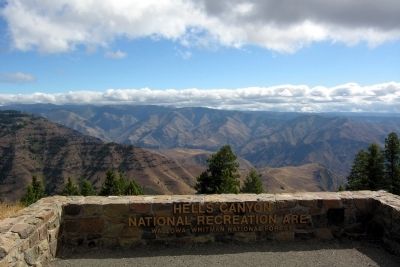
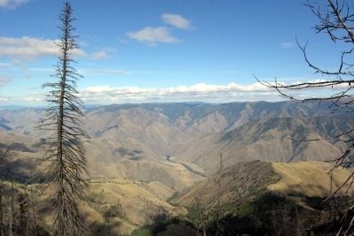
The Snake earns this distinction as it winds its way between towering rock walls, tranquil one moment and treacherous the next. The best way to experience the river is by raft, drift boat or jet boat. But, if you just want to take a look, you can drive to Hells Canyon Dam, Pittsburg Landing or Dug Bar.
Much of Hells Canyon National Recreation Area is designated as “wilderness.” Here, natural processes shape the environment with little human interference. Here, mechanized travel is not permitted. To follow in the footsteps of the Nez Perce and Shoshone Indians, to see a land that looks like much the same today as it did 10,000 years ago, takes a little effort, but it’s well worth the trip.
No matter how you choose to see Hells Canyon National Recreation Area - by car, boat or plane, on foot or horseback - you’ll take home memories that will last a lifetime!
Erected by United States Forest Service.
Topics. This historical marker is listed in this topic list: Natural Features.
Location. 45° 7.445′ N, 116° 50.137′ W. Marker is near Joseph, Oregon, in Wallowa County. Marker can be reached from National Forest Service Road 490, 2 miles east of Wallowa Mountain Loop (Forest Service Road 39). Marker is located on the east side of the Hells Canyon Overlook parking lot. Touch for map. Marker is in this post office area: Joseph OR 97846, United States of America. Touch for directions.
Other nearby markers. At least 4 other markers are within 6 miles of this marker, measured as the crow flies. Look Over Hells Canyon ... (here, next to this marker); A Story Written in Stone (within shouting distance of this marker); Land Of Fire And Water (within shouting distance of this marker); The Bonneville Expedition (approx. 5.9 miles away).
Also see . . .
Hells Canyon National Recreation Area. Official US Forest Service website. (Submitted on February 14, 2014.)
Credits. This page was last revised on June 16, 2016. It was originally submitted on February 14, 2014, by Duane Hall of Abilene, Texas. This page has been viewed 469 times since then and 11 times this year. Photos: 1, 2, 3, 4. submitted on February 14, 2014, by Duane Hall of Abilene, Texas.
Editor’s want-list for this marker. Photo of wide-view of marker and surroundings. • Can you help?


