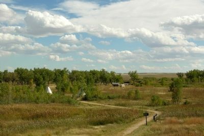
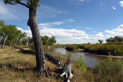
Near La Junta in Otero County, Colorado — The American Mountains (Southwest)
Mountain Men to Merchants
Bent's Old Fort National Historic Site
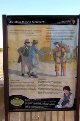
I wish I was capable to do Bent and St. Vrain justice for the kindness received at their hands. I can only say their equals were never in the mountains.
- Christopher “Kit” Carson
Charles Bent
Charles Bent led trade caravans across the sometimes hostile prairie for sixteen years. His ties to the Mexican community, his public service, and his reputation led to his appointment as New Mexicoís first American governor in 1846. Just months after his appointment, an angry mob with ties to Pueblo Indians and the previous Mexican regime murdered Charles Bent in his Taos home.
Ceran St. Vrain
Square-hewn and black-headed, Ceran was a savvy businessman who never shied away from a fight. Though far removed from the courts of France where his grandfather reportedly advised the King, he infused gentility and hospitality into frontier operations. He presided over the table at Bentís Fort with “memorable grace.”
William Bent
The courage of William and Charles Bent, two brothers from Missouri, “... became marked, even in a trade where physical bravery was a staple.” William Bent managed the fort and supervised field operations. William had a knack for establishing harmonious relations with neighboring tribes. Once, at his own peril, he hid two Cheyenne from a band of Comanches. His split second decision won twenty-year old William the gratitude of the Cheyenne.
Kidís Corner
Family at a Distance
Not many kids live here in the fort. I have cousins in Taos and St. Louis. Once in a while a letter arrives. The ones from St. Louis take two months to get here. Sometimes I miss my cousins, but then the next wagon train arrives and I run to greet the crew ...
Erected by National Park Service.
Topics. This historical marker is listed in these topic lists: Exploration • Forts and Castles • Industry & Commerce • Settlements & Settlers. A significant historical year for this entry is 1846.
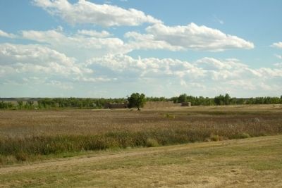
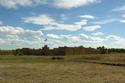
Location. 38° 2.614′ N, 103° 25.893′ W. Marker is near La Junta, Colorado, in Otero County. Marker can be reached from State Highway 194, 0.1 miles east of County Road 35, on the right when traveling east. Marker is located in Bentís Old Fort National Historic Site in a informational kiosk next to the parking lot; the above directions are to the intersection of State Route 194 and the driveway to the Bentís Old Fort parking lot. Touch for map. Marker is in this post office area: La Junta CO 81050, United States of America. Touch for directions.
Other nearby markers. At least 8 other markers are within walking distance of this marker. No Fur, No Fort (here, next to this marker); An Adobe Outpost (here, next to this marker); A Babel-Tongued Multitude (here, next to this marker); A Cast of Colorful Characters (here, next to this marker); Welcome to the Borderlands (here, next to this marker); Trading Post on the Trail (a few steps from this marker); Edward Dorris (approx. 0.2 miles away); Bent's Fort on Santa Fe Trail (approx. 0.2 miles away). Touch for a list and map of all markers in La Junta.
Also see . . .
1. Bent's Old Fort National Historic Site. Official National Park Service website. (Submitted on February 18, 2014.)
2. Bent's Old Fort National Historic Site - Wikipedia entry. (Submitted on February 18, 2014.)
Credits. This page was last revised on June 16, 2016. It was originally submitted on February 18, 2014, by Duane Hall of Abilene, Texas. This page has been viewed 469 times since then and 7 times this year. Photos: 1, 2, 3, 4, 5, 6. submitted on February 18, 2014, by Duane Hall of Abilene, Texas.
Editor’s want-list for this marker. Photo of wide-view of marker and surroundings. • Can you help?
