Near Fowler in Benton County, Indiana — The American Midwest (Great Lakes)
Indian Boundary Line
1818 to 1832
(Tablet 1)
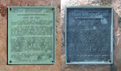
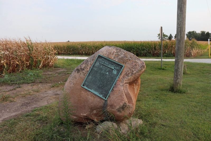
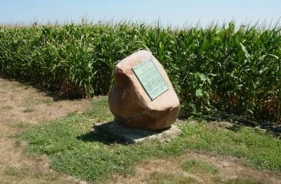
This boulder marks a boundary line between United States territory and Indian lands which existed for fourteen years.
At St. Mary's Ohio on October 2, 1818, a treaty was made and concluded between Jonathan Jennings, Lewis Cass, and Benjamin Parke, Commissioners of the United States, and 35 of the Sachem's Chiefs and Warriors of the Potawatomie Tribe of Indians ceding the following territory,-
"Beginning at the mouth of the Tippecanoe River, and running up the same to a point twenty five miles in a direct line from the Wabash River, thence on a line (this) as nearly parallel to the general course of the Wabash River as practicable, to a point on the Vermilion River, twenty five miles from the Wabash River; thence down the vermilion River to its mouth and thence up the Wabash River to the place of beginning."
For which the United States agreed to pay to the Potawatomies a perpetual annuity of $2,500.00 in silver.
At Chippewaynung, (where the Tippecanoe River crosses the Michigan Road, 2 miles north of Rochester, Ind.,) on October 26, 1832, a treaty was made and concluded by Jonathan Jennings, John W. Davis, and Marks Crume, Commissioners of the United States, and 48 Chiefs, Headman, and Warriors of the Potawatomie Indians, whereby all lands lying between this line and the Ind.-Ill. state line, Lake Michigan, and the Ind.-Mich. state line, were ceded to the United States.
For which the United States agreed to pay $20,000.00 annually for 20 years, goods to the value of $100,000.00 in 1832, and of $30,000.00 value in 1833, pay Indian debts of $62,412.00, help them in emigrating, and build them a sawmill.
Boulder placed by A.G. Mitton, Goodland, Ind.,
Unveiled September 14, 1930.
Erected 1930.
Topics. This historical marker is listed in these topic lists: Native Americans • Peace. A significant historical date for this entry is September 14, 1930.
Location. 40° 39.011′ N, 87° 19.424′ W. Marker is near Fowler, Indiana, in Benton County. Marker is at the intersection of 3000 County Road 300 E (State Road 55) and County Road E 300 N, on the right when traveling north on 3000 County Road 300 E. Touch for map. Marker is in this post office area: Fowler IN 47944, United States of America. Touch for directions.
Other nearby markers. At least 8 other markers are within 9 miles of this marker, measured as the crow flies. Fraser & Isham Law Office (approx. 2.3 miles away); Vincent and Eileen Schwartz Parking Lot (approx. 2.3 miles away); Benton County American Revolution Memorial (approx. 2.3 miles away); Benton Bounty Veterans Memorial (approx. 2.3 miles away); Benton County Courthouse (approx. 2.3 miles away); Benton County Wind Corridor Kiosk (approx. 3 miles away); New Purchase Boundary (approx. 3.1 miles away); Foster Park (approx. 8.1 miles away). Touch for a list and map of all markers in Fowler.
Credits. This page was last revised on July 9, 2022. It was originally submitted on February 22, 2014, by Chuck Green of Glen Allen, Virginia. This page has been viewed 727 times since then and 49 times this year. Photos: 1. submitted on February 22, 2014, by Chuck Green of Glen Allen, Virginia. 2. submitted on June 19, 2022, by Trevor L Whited of Kokomo, Indiana. 3. submitted on February 22, 2014, by Chuck Green of Glen Allen, Virginia. • Bernard Fisher was the editor who published this page.


