Wabasha in Wabasha County, Minnesota — The American Midwest (Upper Plains)
The Bridge
Wabasha-Nelson Bridge Company
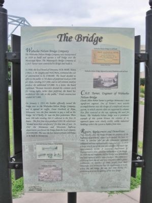
The Wabasha-Nelson Bridge Company was incorporated in 1929 to build and operate a toll bridge over the Mississippi River. The Minneapolis Bridge Company & C.A.P. Turner were contracted to design and build it.
In 1930, the local Board of Directors, W.B. Webb, Henry J. Mars, S. M. Quigley and Nick Marx, estimated the cost of construction to be $500,000. The board decided to offer to the public 4,750 shares of preferred stock at $100 per share, totaling $475,000, and to sell common stock to produce the additional $25,000. In a letter, the board explained, "Because investors desired the common stock for voting rights rather than preferred, the board has authorized this sale to the public." Final construction totaled $675,000.
On January 1, 1931 the builder officially turned the bridge over to the Wabasha-Nelson Bridge Company, and it opened to traffic. Oscar Overbeck of Alma, Wisconsin, was the first motorist to pay a toll on the bridge. Ed O'Reilly, Sr. was the first pedestrian. There were 190 tolls totaling $60.35 collected in the first 24 hours. The first four days produced $282.30, which was "deemed more than satisfactory" for that time of year. In 1947 the Minnesota and Wisconsin highway departments purchased the bridge from the local company for $400,000. This was the last known private toll bridge to be built in Minnesota.
C.A.P. Turner, Engineer of Wabasha-Nelson Bridge
Claude Allen Porter Turner is perhaps Minnesota's most significant engineer. One of Turner's most notable accomplishments was the design of a reinforced concrete system, in which concrete slabs are supported by columns that flair outward at the top, replacing the need for beams. The Wabasha-Nelson bridge was a prominent example of this system because the columns of its approach spans were clearly visible, unlike industrial buildings where the system is hidden from view.
Repairs, Replacement and Demolition
Two decades after the bridge became the property of the highway departments, repairs were needed. On June 12, 1968, a concrete pier on the Wisconsin approach collapsed and was replaced with a new steel pier. In 1970 a barge struck one of the new pier caissons; the repair cost approximately $6500. A statewide Department of Transportation plan called for replacement of the bridge. In 1988 the old Wabasha-Nelson Bridge was demolished and was replaced with a new structure. The community celebrated both the old and new structures with a grand celebration. In October of 1988 people from both Wisconsin and Minnesota had the opportunity to walk across the old bridge for one last time during the celebration prior
to the opening of the new bridge.
City of
Wabasha
Discover more of Wabasha at www.wabasha.org
Erected by the City of Wabasha.
Topics. This historical marker is listed in this topic list: Bridges & Viaducts. A significant historical date for this entry is January 1, 1931.
Location. 44° 23.144′ N, 92° 2.063′ W. Marker is in Wabasha, Minnesota, in Wabasha County. Marker is at the intersection of Lawrence Boulevard West and Bridge Avenue, on the left when traveling east on Lawrence Boulevard West. Touch for map. Marker is in this post office area: Wabasha MN 55981, United States of America. Touch for directions.
Other nearby markers. At least 8 other markers are within 4 miles of this marker, measured as the crow flies. Wapahasha I / Wapahasha II / Wapahasha III (approx. 0.2 miles away); Grace Memorial Episcopal Church (approx. 0.3 miles away); Minnesota Territory 1849-1858 / Wabasha County Takes Shape (approx. 0.4 miles away); Veterans Memorial (approx. half a mile away); a different marker also named Veterans Memorial (approx. 2.7 miles away in Wisconsin); Lake Pepin (approx. 4 miles away); a different marker also named Lake Pepin (approx. 4 miles away); The River of Rafts (approx. 4 miles away). Touch for a list and map of all markers in Wabasha.
More about this marker. captions:
Wabasha-Nelson Bridge Co toll book Courtesy
of Norb Flicek
Wabasha-Nelson Bridge Approach at end of Pembroke with toll booth Courtesy of Rollin Schmidt
Postcard showing Wabasha-Nelson Bridge Courtesy of Hardy Schierts
Wabasha-Nelson Bridge Courtesy of Rollin Schmidt
Background image: Stock Certificate for the 1931 Bridge (top) • Postcard of bridge (bottom) courtesy of Hardy Schierts
Also see . . .
1. Wabasha’s Chronological History & Heritage. City of Wabasha, Minnesota. "Wabasha was named in honor of an Indian Chief of the Sioux Nation, Chief Wa-pa-shaw." (Submitted on February 24, 2014.)
2. Wabasha, Minnesota. Wikipedia entry. "Upon entering Wabasha you will see a sign reading 'Welcome to Wabasha, Home of Grumpy Old Men.'" (Submitted on February 24, 2014.)
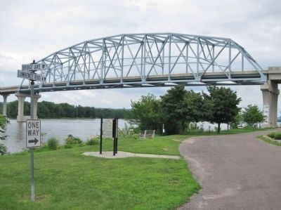
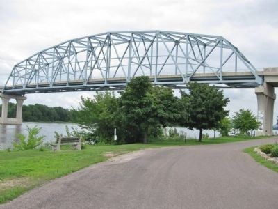
3. Wabasha-Nelson Bridge. John A. Weeks III Bridge photography. "The current bridge at Wabasha replaced a similar looking steel bridge from the 1930's." (Submitted on February 24, 2014.)
4. Wabasha–Nelson Bridge. Wikipedia entry. (Submitted on February 24, 2014.)
Credits. This page was last revised on June 16, 2016. It was originally submitted on February 24, 2014, by Keith L of Wisconsin Rapids, Wisconsin. This page has been viewed 1,340 times since then and 113 times this year. Photos: 1, 2, 3. submitted on February 24, 2014, by Keith L of Wisconsin Rapids, Wisconsin.


