Laurel in Prince George's County, Maryland — The American Northeast (Mid-Atlantic)
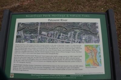
Patuxent River
Riverfront Park Heritage & Nature Trail
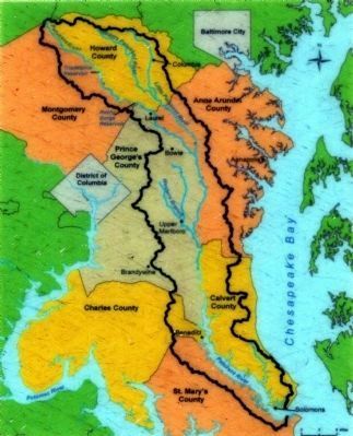
The Patuxent River was first named "Pawtuxunt" from Captain John Smith's voyage upriver in 1608. Captain Smith got as far as Lyons Creek area, 40 miles from the Chesapeake. By the mid and late 1600's colonists spread upriver to Mt. Calvert and Billingsly Point, two colonial mansions approximately 44 miles from the Chesapeake. By the early 1700's, the Snowden iron ore furnace was shipping "pig iron" downriver from the current vicinity of the 1783 Montpelier Mansion.
The Washington Suburban Sanitary Commission constructed two dams on the main branch in the mid 20th century. Brighton Dam was constructed 96 miles from the Chesapeake in 1943, impounding the waters of Triadelphia Reservoir. The T. Howard Duckett Dam was constructed in 1952 and is located outside of Laurel. This dam creates the Rocky Gorge Reservoir.
Erected by City of Laurel.
Topics. This historical marker is listed in this topic list: Waterways & Vessels. A significant historical year for this entry is 1608.
Location. 39° 6.46′ N, 76° 50.763′ W. Marker is in Laurel, Maryland, in Prince George's County. The marker is in Laurel's Riverfront Park Heritage & Nature Trail, just south of the Patuxent River. There is a parking lot at the north end of 4th and Avondale Streets, and the marker is in that section of the park. Touch for map. Marker is in this post office area: Laurel MD 20707, United States of America. Touch for directions.
Other nearby markers. At least 8 other markers are within walking distance of this marker. Riverfront Park (within shouting distance of this marker); Avondale Mill: A Lost Treasure (within shouting distance of this marker); Avondale Mill (within shouting distance of this marker); Site of Laurel's Civil War Hospital (approx. 0.2 miles away); An Angel Among US (approx. 0.2 miles away); First United Methodist Church of Laurel (approx. 0.2 miles away); A “Little Dam” Powers the Avondale Mill (approx. 0.2 miles away); Laurel: Half-way between Baltimore and Washington (approx. ¼ mile away). Touch for a list and map of all markers in Laurel.
Also see . . . Patuxent River (Wikipedia)
. (Submitted on March 3, 2014, by A. Taylor of Laurel, Maryland.)

Photographed By Allen C. Browne
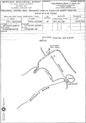
3. Source of the Patuxent River
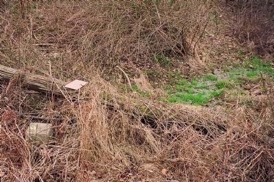
The Patuxent River begins at the HM Stone (marked here in red) on the Day Farm on the Border of Howard and Montgomery Counties at (39° 20' 47.75843", -77° 10' 47.69787"). The stone is just off the south west corner of the property at 960 Ridge Road. MD Geological Survey Sheet Prepared by Frey, Sheehan & Associates.
Credits. This page was last revised on June 16, 2016. It was originally submitted on March 3, 2014, by A. Taylor of Laurel, Maryland. This page has been viewed 708 times since then and 27 times this year. Photos: 1. submitted on March 3, 2014, by A. Taylor of Laurel, Maryland. 2, 3, 4. submitted on November 23, 2014, by Allen C. Browne of Silver Spring, Maryland. • Bill Pfingsten was the editor who published this page.


