Near Lonoke in Lonoke County, Arkansas — The American South (West South Central)
Hicks' Station in the Civil War
Inscription.
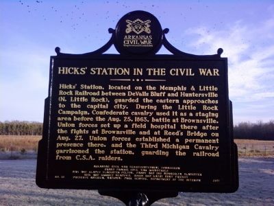
Hicks' Station, located on the Memphis & Little Rock Railroad between DeValls Bluff and Huntersville (N Little Rock), guarded the eastern approaches to the capital city. During the Little Rock Campaign, Confederate cavalry used it as a staging area before the Aug. 25, 1863, battle at Brownsville. Union forces set up a field hospital there after the fights at Brownsville and at Reed's Bridge on Aug. 27. Union forces established a permanent presence there, and the Third Michigan Cavalry garrisoned the station, guarding the railroad from C.S.A. raiders.
Erected 2011 by Arkansas Civil War Sesquicentennial Commission. (Marker Number 16.)
Topics and series. This memorial is listed in these topic lists: Railroads & Streetcars • Settlements & Settlers • War, US Civil. In addition, it is included in the Arkansas Civil War Sesquicentennial Commission series list. A significant historical month for this entry is August 1890.
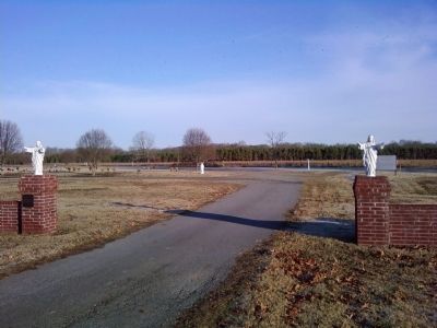
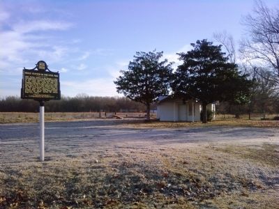
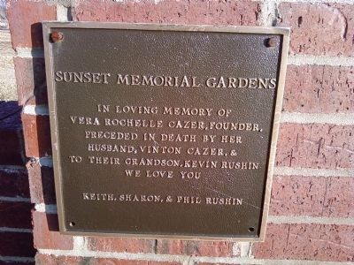
Location. 34° 47.056′ N, 91° 52.421′ W. Marker is near Lonoke, Arkansas, in Lonoke County. Memorial is on SE Front Street (U.S. 70) one mile east of Honeysuckle Lane, on the left when traveling east. Marker is located in Sunset Memorial Gardens, about 1.5 miles east of downtown Lonoke on US-70. Touch for map. Marker is in this post office area: Lonoke AR 72086, United States of America. Touch for directions.
Other nearby markers. At least 8 other markers are within 3 miles of this marker, measured as the crow flies. Eberts Air Field (approx. 1.4 miles away); A Gun for All Reasons (approx. 1˝ miles away); Senator Joe T. Robinson (approx. 1˝ miles away); Lonoke County Confederate Monument (approx. 1˝ miles away); Lonoke Landmarks (approx. 1˝ miles away); Lonoke County Honor Roll (approx. 1˝ miles away); The Lonoke Depot (approx. 1˝ miles away); Battle of Brownsville (approx. 2.2 miles away). Touch for a list and map of all markers in Lonoke.
Additional commentary.
1. Hicks' Station
Hicks Station is the first stop in the "Ashley's and Jones' Stations Battlefield" Driving Tour pamphlet I recently received from the Department of Arkansas Heritage. It is a driving tour of sites along Highway 70 from Lonoke to DeValls Bluff. Here is the text about Hicks Station from the pamphlet:
"Named after an early settler of Prairie County. In 1863 Isaac Hicks owned many acres of land in the area. He constructed the station, which was located 2.5 miles south of Brownsville to move goods produced in the vicinity to markets near Huntersville (North Little Rock). This area was a good source of water and was used as a camp for both Union and Confederate troops. Hicks Station served as a strategic point along one of the main approaches to the capital in Little Rock. It was near the Old Military Road (Memphis to Little Rock Road) and was located along the first railroad line in the state. Troops and supplies were shuttled between North Little Rock and DeValls Bluff.
The old road to Brownsville was used by Confederate General William L. Jeffers to move his 600 cavalry troops in the August 1863 skirmish at Brownsville, a city of about 2,500 residents before the war. This old road runs north from the current ball fields on Highway 70 east of town."
— Submitted March 6, 2014, by Lee Hattabaugh of Capshaw, Alabama.
Credits. This page was last revised on January 20, 2020. It was originally submitted on March 6, 2014, by Lee Hattabaugh of Capshaw, Alabama. This page has been viewed 1,272 times since then and 41 times this year. Photos: 1, 2, 3, 4. submitted on March 6, 2014, by Lee Hattabaugh of Capshaw, Alabama. • Bill Pfingsten was the editor who published this page.


