Parkers Crossroads in Henderson County, Tennessee — The American South (East South Central)
The Battle of Parker's Crossroads
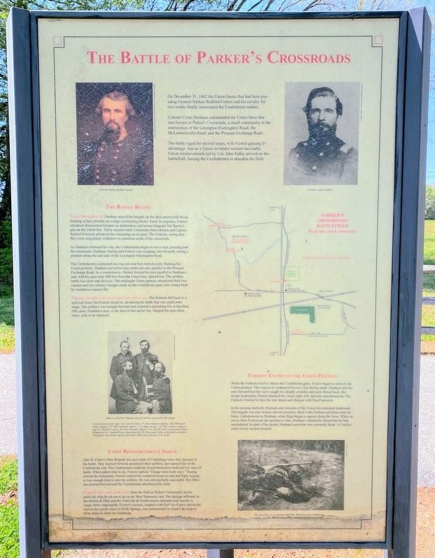
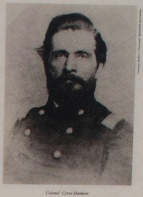
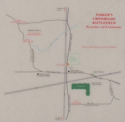
Colonel Cyrus Dunham commanded the Union force that met Forrest at Parker's Crossroads, a small community at the intersection of the Lexington-Huntingdon Road, the McLemoresville Road, and the Pleasant Exchange Road.
The battle raged for several hours, with Forrest gaining the advantage. Just as a Union surrender seemed inevitable, Union reinforcements led by Colonel John Fuller arrived on the battlefield, forcing the Confederates to abandon the field.
Early December 31 Dunham moved his brigade up the McLemoresville Road, forming in line of battle on a ridge overlooking Hicks' Field. In response, Forrest advanced dismounted troopers as skirmishers and turned Sergeant Nat Baxter's gun on the Union line. Thirty minutes later, Lieutenant John Morton and Captain Samuel Freeman advanced the remaining seven guns. The Federals, seeing that they were outgunned, withdrew to a position south of the crossroads.
As Dunham reformed his line, the Confederates began to move east, pressing past the crossroads. Dunham, fearing that Forrest was escaping, moved north, taking a position on the east side of the Lexington-Huntingdon Road.
The Confederates continued moving east and then turned south, flanking the Union position. Dunham moved his line north and east, parallel to the Pleasant Exchange Road. In a countermove, Forrest formed his men parallel to Dunham's and, with his guns only 600 feet from the Union line, opened fire. The artillery battle was short and decisive. The outfought Union gunners abandoned their two cannon and two infantry charges made on the Confederate guns were turned back by murderous cannon fire.
Forrest pressed his advantage and advanced. The Federals fell back to a split-rail fence but Forrest closed in, advancing his battle line into small arms range. The artillery was brought forward and resumed a punishing fire at less than 200 yards. Dunham's men, in the face of this awful fire, charged the guns three times, only to be repulsed.
While the Federals tried to silence the Confederate guns, Forrest began to encircle the Union position. This maneuver weakened Forrest's line facing south. Dunham sent his men forward but they were caught in a deadly crossfire and were forced back. His troops in position, Forrest attacked the Union right, left, and rear simultaneously. The Federals wheeled to face the new threat and charged with fixed bayonets.
In
the ensuing skirmish, Dunham and elements of the Union line retreated southward. The brigade was now broken into two pockets, those with Dunham and those near the fence. Unbeknownst to Dunham, white flags began to appear along the fence. When an envoy from Forrest put the question to him, Dunham vehemently denied that he had surrendered. In spite of his denial, Dunham's position was extremely bleak. A Confederate victory seemed assured.
John W. Fuller's Ohio Brigade was just south of Clarksburg when they learned of the battle. They hurried forward, positioned their artillery, and opened fire on the Confederate rear. The Confederates suddenly found themselves between two lines of battle. When asked what to do, Forrest replied, "Charge them both ways." Racing toward the crossroads, Forrest ordered his scattered troops to turn and fight, hoping to buy enough time to save his artillery. He was only partially successful. The Ohioans pressed forward and the Confederates abandoned the field.
Forrest may have retreated from the field at Parker's Crossroads, but he achieved what he set out to do on his West Tennessee raid. The damage inflicted on the Mobile & Ohio and the Nashville & Northwestern railroads took months to repair. More importantly, Forrest's success, coupled with Earl Van Dorn's successful raid on the supply depot at Holly Springs, was instrumental in Grant's decision to delay plans to move on Vicksburg.
Topics. This historical marker is listed in this topic list: War, US Civil. A significant historical month for this entry is December 2011.
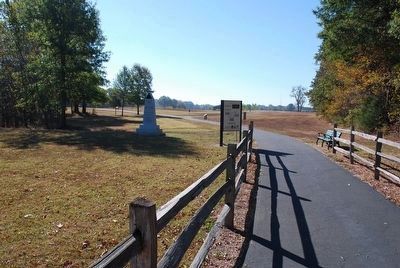
Location. 35° 47.782′ N, 88° 23.415′ W. Marker is in Parkers Crossroads, Tennessee, in Henderson County. Marker can be reached from Tennessee Route 22, 0.6 miles north of Interstate 40, on the right when traveling north. Marker is one panel of a 3-sided kiosk beside the North Loop Walking Trail. It is located 340 feet from the start of the trail just before where the trail splits. The marker is at Tour Stop 1 (Parkers Crossroads City Park) of the Driving Tour. Touch for map. Marker is in this post office area: Wildersville TN 38388, United States of America. Touch for directions.
Other nearby markers. At least 8 other markers are within walking distance of this marker. Morton's Battery (here, next to this marker); The Tides of War (a few steps from this marker); Forrest's West Tennessee Raid (a few steps from this marker); Forrest's Tactics (within shouting distance of this marker); a different marker also named The Battle of Parker's Crossroads (about 300 feet away, measured in a direct line); a different marker also named The Battle of Parker's Crossroads (about 300 feet away); Freeman's Battery (about 300 feet away); Flight to Safety (about 300 feet away). Touch for a list and map of all markers in Parkers Crossroads.
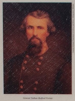
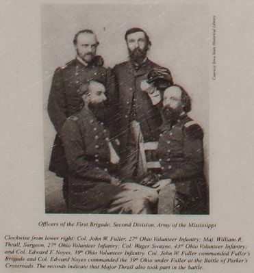
Regarding The Battle of Parker's Crossroads. The marker includes portraits of General Nathan Bedford Forrest and Colonel Cyrus Dunham, a photograph of four Officers of the First Brigade, Second Division, Army of the Mississippi, and a photo of a dead soldier (Petersburg?) captioned "The cost of any war is immeasurably high. Both Union and Confederate soldiers paid the ultimate price for their beliefs at Parker's Crossroads." Also a map of Parker's Crossroads Battlefield: Features and Landmarks.
Credits. This page was last revised on June 4, 2021. It was originally submitted on March 10, 2014, by David Graff of Halifax, Nova Scotia. This page has been viewed 649 times since then and 25 times this year. Photos: 1. submitted on May 30, 2021, by Shane Oliver of Richmond, Virginia. 2, 3, 4, 5, 6. submitted on August 22, 2015, by Brandon Fletcher of Chattanooga, Tennessee. • Bernard Fisher was the editor who published this page.
