Piedmont Avenue in Oakland in Alameda County, California — The American West (Pacific Coastal)
Key Route Train Station
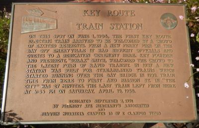
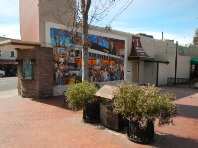
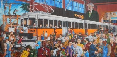
On this spot on June 1, 1904, the first Key Route electric train arrived to be welcomed by a crowd of excited residents. From a new ferry pier on the bay off Emeryville it had brought officials and guests to a dedication ceremony here. Key founder and president, “Borax” Smith welcomed the crowd to the latest form of rapid transit. In 1937 a new station was built for streamlined trains which started running over the Bay Bridge in 1939. Train time from here to First and Mission St. in “The City” was 26 minutes. The last train left from here at 6:45 PM on Saturday, April 19, 1958.
Erected 1991 by Piedmont Ave Merchant’s Association and E Clampus Vitus, Joaquin Murrieta Chapter 13.
Topics and series. This historical marker is listed in this topic list: Railroads & Streetcars. In addition, it is included in the E Clampus Vitus series list. A significant historical date for this entry is April 19, 1852.
Location. 37° 49.587′ N, 122° 15.164′ W. Marker is in Oakland, California, in Alameda County. It is in Piedmont Avenue. Marker is on 41st Street near Piedmont Avenue, on the left when traveling south. Touch for map. Marker is at or near this postal address: 151 41st Street, Oakland CA 94611, United States of America. Touch for directions.
Other nearby markers. At least 8 other markers are within walking distance of this marker. El Camino Rancho San Antonio (approx. 0.4 miles away); Antonio Bras Columns (approx. half a mile away); Governor Juan Bautista Alvarado (approx. 0.6 miles away); Morcom Amphitheater of Roses (approx. 0.6 miles away); Connell Motor Company (approx. 0.6 miles away); Site of Saint Mary's College (approx. 0.7 miles away); In Memory of Col. John Coffee Hays (approx. 0.8 miles away); Here, Over Time (approx. 0.8 miles away). Touch for a list and map of all markers in Oakland.
Also see . . . Key System. Oklandwiki website entry:
The name is based in part on the shape of the ferry slips on the old Key System Mole. On a stylized map first issued in 1903, the system’s routes were drawn to resemble an old-fashioned key, including a three-looped handle covering Berkeley, Piedmont (or Piedmont/Claremont) and Oakland, a shaft in the form of the Mole, and teeth representing the ferry slips. Each of the systems’ routes was given a letter and a unique symbol, so riders could spot the correct train from a distance. (Submitted on March 13, 2014, by Barry Swackhamer of Brentwood, California.)

Photographed By Barry Swackhamer, March 7, 2014
4. Key Route Interpretative Panel
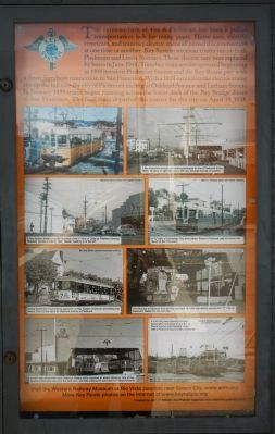
The intersection of 41st and Piedmont has been a public transportation hub for many years. Horse cars, electric streetcars and transbay electric trains all passed this intersection at one time or another. Key System streetcar routes ran boat Piedmont and Linda Avenues. Those electric cars were replaced by buses in June 1948. Transbay train service operated beginning in 1904 between Piedmont Station and the Key Route pier with a direct ferryboat connection to San Francisco. With a 1924 extension the electric trains ran up the hill to the city of Piedmont ending at Oakland Avenue and Latham Streets. In January 1939 trains began running across the lower deck of the Bay Bridge direct to San Francisco. The final train departed this corner for the city on April 19, 1958.
To view the pictures and read their captions, click on the image to enlarge it.
To view the pictures and read their captions, click on the image to enlarge it.
Credits. This page was last revised on February 7, 2023. It was originally submitted on March 13, 2014, by Barry Swackhamer of Brentwood, California. This page has been viewed 784 times since then and 24 times this year. Photos: 1, 2, 3, 4. submitted on March 13, 2014, by Barry Swackhamer of Brentwood, California. • Syd Whittle was the editor who published this page.


