Near Menard in Menard County, Texas — The American South (West South Central)
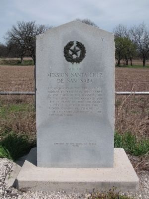
Site of Mission Santa Cruz de San Saba
Erected 1936 by State of Texas. (Marker Number 4835.)
Topics and series. This historical marker is listed in these topic lists: Hispanic Americans • Native Americans • Notable Events • Settlements & Settlers. In addition, it is included in the Texas 1936 Centennial Markers and Monuments series list. A significant historical year for this entry is 1757.
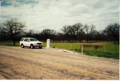
Location. 30° 54.991′ N, 99° 44.097′ W. Marker is near Menard, Texas, in Menard County. Marker is on Farm to Market Road 2092, 3.1 miles east of U.S. 83, on the left when traveling east. Touch for map. Marker is in this post office area: Menard TX 76859, United States of America. Touch for directions.
Other nearby markers. At least 8 other markers are within 3 miles of this marker, measured as the crow flies. Menard County Courthouse (approx. 2.9 miles away); Oliver Prince Smith (approx. 2.9 miles away); Great Western Trail (approx. 2.9 miles away); Menard County Memorial of Those Who Died (approx. 2.9 miles away); Fort McKavett C.S.A. / Texas Civil War Frontier Defense (approx. 2.9 miles away); Paso de la Santa Cruz (approx. 3 miles away); Frisco Depot (approx. 3 miles away); Welcome to Menard, Texas (approx. 3 miles away). Touch for a list and map of all markers in Menard.
Also see . . .
1. Mission San Saba, Texas Beyond History website. Good overview of recent archaelogical work (1990s) that led to discovery of the Mission's actual location. (Submitted on February 12, 2010, by Richard Denney of Austin, Texas.)
2. Handbook of Texas Online. (Submitted on February 12, 2010, by Richard Denney of Austin, Texas.)
3. Archeology and golf seek harmony in Menard, Texas. Golf meets archaeology. Article from GolfTexas.com about the nearby Presidio San Saba. (Submitted on February 12, 2010, by Richard Denney of Austin, Texas.)
4. Presidio San Saba, Texas Beyond History website. Overview of the Presidio associated with the Mission San Saba. (Submitted on February 12, 2010, by Richard Denney of Austin, Texas.)
Additional commentary.
1. Confusion about Mission and Presidio
Two points of confusion worth noting about the Presidio and Mission San Saba if you are planning a trip there. One might reasonably guess that
the Presidio and Mission San Saba were located in San Saba, Texas, but they are in fact in Menard, Texas. Also, the Presidio is often mistakingly called the Mission. Even Google Maps as of 2010, mistakingly labels the Presidio San Saba (which is on the golf course in Menard) as Mission San Saba. As the marker describes, the Mission was destroyed in 1758, and its location only recently confirmed in the 1990s.
— Submitted February 12, 2010, by Richard Denney of Austin, Texas.
Credits. This page was last revised on June 5, 2020. It was originally submitted on February 12, 2010, by Richard Denney of Austin, Texas. This page has been viewed 3,865 times since then and 49 times this year. Last updated on March 14, 2014, by Richard Denney of Austin, Texas. Photos: 1. submitted on April 8, 2010, by Richard Denney of Austin, Texas. 2. submitted on February 12, 2010, by Richard Denney of Austin, Texas. 3. submitted on April 24, 2010, by Gregory Walker of La Grange, Texas. • Bill Pfingsten was the editor who published this page.


