Near La Pine in Deschutes County, Oregon — The American West (Northwest)
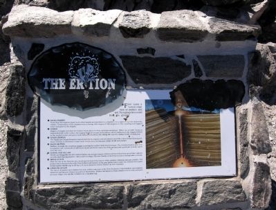
The Eruption
(Graphic Index)
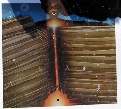
1 Magma Chamber
From deep hot regions, liquid rock called magma accumulated in a chamber 2 to 4 miles (3 to 6 km) below the surface. Temperature of the chamber was a roasting 1600 degrees F (900 degrees C). The overlying rock trapped water and gases in the magma.
2 Conduit
Fingers of magma searched for hidden weak places in their underground prison. When one of these found an unguarded path to the surface, the magma began its escape. In its journey out of confinement, the magma frothed as the trapped water and gases made billions of bubbles, like taking the cap off a shaken bottle of soda pop.
3 Violent Eruption
The highly gas-charged magma erupted explosively; pumice and ash blasted out of the vent at tremendous speed. Areas of forest in Newberry Crater were swept away, leaving gray plains of ash and pumice.
4 Passive Eruption
Halfway through the eruption, magma reaching the surface held much less gas. The violent eruption gave way to a passive one. A mixture of stiff, sticky liquid and froth oozed out of the ground, and a great pile (a dome) grew over the vent.
5 Flowing Over the Land
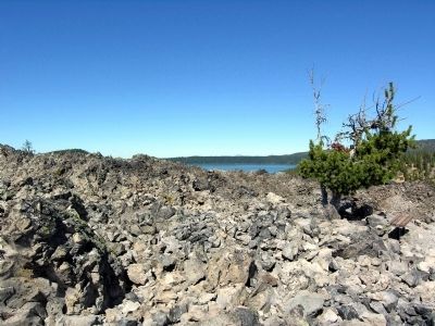
Slowly and sluggishly, the lava moved inches (or cm) per hour. A 100-foot (30 m) wall of lava moved like a glacier over the land, burying shallow valleys and low ridges. The low fluidity of the flow was due to its high silica content.
6 Middle of the Flow
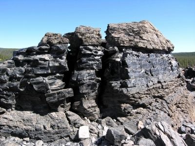
Near the top of the flow, the lava developed at least three layers: white pumice, obsidian, and gray pumice. The pumice layers formed where the flow frothed and foamed. In the gray pumice layer under the obsidian layer, gases formed giant bubbles up to 50 feet (15 m) in diameter, which floated up and exploded.
7 Lower End of Flow
The layers of pumice and obsidian became wildly contorted as the flow thickened. Layers folded and refolded, shattered and sheared, flowed up and over themselves. Pumice attempted to float, obsidian tried to sink, and great pressure ridges rose up like wrinkles on a rumpled rug.
Erected by United States Forest Service.
Topics. This historical marker is listed in this topic list: Natural Features.
Location. 43° 42.304′ N, 121° 14.139′ W. Marker is near La Pine, Oregon, in Deschutes County. Marker can be reached from Paulina Lake Road (NF-21), 0.7 miles east of National Forest Service Road 567 (NF-567). Marker is located on the Big Obisidian Flow Trail in the Newberry Crater unit of Newberry National Volcanic Monument; the above directions are to the intersection of Paulina Lake Road and the driveway to the Big Obsidian Flow parking lot. Touch for map. Marker is in this post office area: La Pine OR 97739, United States of America. Touch for directions.
Other nearby markers. At least 5 other markers are within 15 miles of this marker, measured as the crow flies. Glass Menagerie (within shouting distance of this marker); Big Obsidian Flow (about 400 feet away, measured in a direct line); A Special Place on the Planet (about 700 feet away); Lava River Cave (approx. 14.7 miles away); Some Lava Flows Build Their Own Pipelines (approx. 14.7 miles away).
More about this marker. Marker is the third of seven interpretive signs along the Big Obsidian Flow Trail.
Credits. This page was last revised on June 16, 2016. It was originally submitted on March 19, 2014, by Duane Hall of Abilene, Texas. This page has been viewed 382 times since then and 13 times this year. Photos: 1, 2, 3, 4, 5. submitted on March 19, 2014, by Duane Hall of Abilene, Texas.
Editor’s want-list for this marker. Photo of wide-view of marker and surroundings. Photos of markers along trail missing from HMDB. • Can you help?
