Near Warsaw in Kosciusko County, Indiana — The American Midwest (Great Lakes)
Chinworth Bridge Trailhead
Chinworth Bridge Trailhead
Lake City Greenway
Former Tippecanoe Rest Park
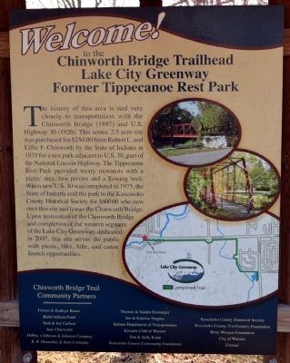
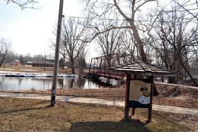
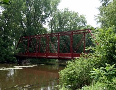
The history of this area is tied very closely to transportation with the Chinworth Bridge (1897) and U.S. Highway 30 (1926). This scenic 2.5 acre site was purchased for $250.00 from Robert L. And Lillie F. Chinworth by the State of Indiana in 1939 for a rest park adjacent to U.S. 30, part of the National Lincoln Highway. The Tippecanoe Rest Park provided weary motorists with a picnic area, two privies and a flowing well. When new U.S. 30 was completed in 1975, the State of Indiana sold the park to the Kosciusko County Historical Society for $600.00 who now own this site and leases the Chinworth Bridge. Upon restoration of the Chinworth Bridge and completion of the western segment of the Lake City Greenway, dedicated in 2007, this site serves the public with picnic, bike, hike, and canoe launch opportunities.
Topics. This historical marker is listed in these topic lists: Bridges & Viaducts • Roads & Vehicles. A significant historical year for this entry is 1939.
Location. 41° 14.85′ N, 85° 54.638′ W. Marker is near Warsaw, Indiana, in Kosciusko County. Marker can be reached from the intersection of Old U.S. 30 and County Road N350W, on the right when traveling east. Marker is located at the west end of the Chinworth Bridge Trailhead park. Touch for map. Marker is in this post office area: Warsaw IN 46580, United States of America. Touch for directions.
Other nearby markers. At least 8 other markers are within 3 miles of this marker, measured as the crow flies. Indiana ... Where It All Began! (here, next to this marker); The Lincoln Highway (here, next to this marker); Chinworth Bridge (a few steps from this marker); Highland Cemetery (approx. 2.2 miles away); Tony Elliott (approx. 2.6 miles away); a different marker also named The Lincoln Highway (approx. 2.6 miles away); M3A3 Stuart Tank (approx. 2.8 miles away); Kosciusko County War Memorial (approx. 2.8 miles away). Touch for a list and map of all markers in Warsaw.
Credits. This page was last revised on June 16, 2016. It was originally submitted on March 24, 2014, by Duane Hall of Abilene, Texas. This page has been viewed 481 times since then and 15 times this year. Photos: 1, 2, 3. submitted on March 24, 2014, by Duane Hall of Abilene, Texas. 4. submitted on July 23, 2011, by Dave Zollinger of Goshen, Indiana.


