Belleek in Fermanagh And Omagh, Northern Ireland, United Kingdom — Northwestern Europe (the British Isles)
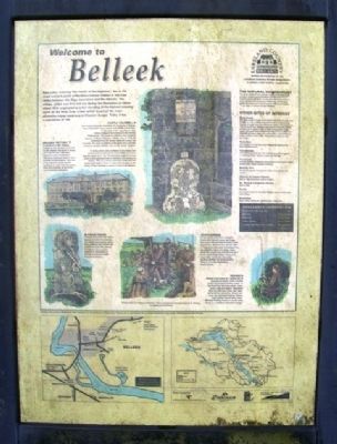
Welcome to Belleek
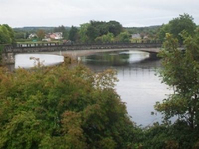
Beal Leice, meaning 'the mouth of the flagstone', lies in the most westerly point of Northern Ireland, hidden in the Erne valley between the Sligo mountains and the Atlantic. The village, which was first laid out during the Plantation of Ulster about 1610, originated as a fort standing at the highest crossing point on the River Erne, a river which is part of the most extensive inland waterway in Western Europe. Today it has a population of 790.
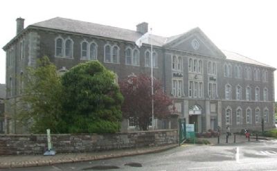
Belleek Pottery
Established in 1857, Belleek Pottery is now famous world wide for the highest standards in design and craftsmanship, with eash distinctive piece handcrafted following techniques handed down through the generations. Join one of the regular tours to see the craftsmen at work, visit the pottery shop and museum, or eat in the award-winning restaurant.
Castle Caldwell
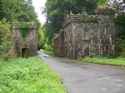
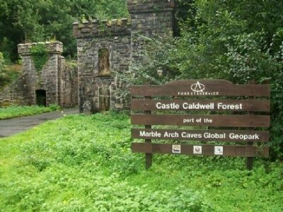
Once the home of the Caldwells, the landlords of Belleek, Castle Caldwell is now a nature and wildlife Forest Park. To the right of the magnificent stone railway bridge at the entrance is the famous Fiddlestone. This unusual sculpture was carved in memory of Dennis McCabe, a fiddler who, in 1770, fell overboard from Sir James Caldwell's barge and drowned. The verse inscribed on the stone was probably written by Captain Risdale, tutor to Sir James' children.
A visitor centre and exhibition at the forest park provides information about local wildlife and has a dug-out canoe and a "cot" (a traditional Lough Erne boat used to ferry grazing livestock between the islands) on display. There is a marine and forest walks but the castle itself, built in 1612, is a ruin and not open to the public. Castle Caldwell is approx. 5 miles from Belleek.
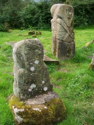
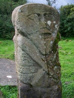
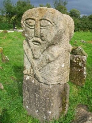
Janus Figure
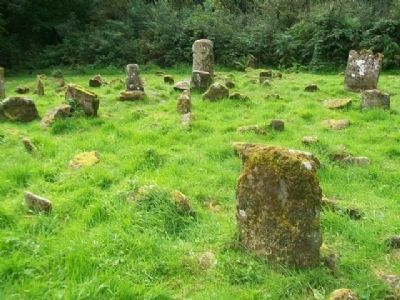
Caldragh Graveyard, Bos Island. Approx. 10 miles from Belleek. Two Celtic stone figures, one of them Janiform (two-faced), the other from Lusty More Island. The figures are on private property so permission to visit them must be sought from the landowner.
Explorerne
A high quality exhibition in English, French and German about the Lough Erne area, from pre-historic times to the present day. Discover how the 52 miles of lough have been used and shaped into the beautiful region it is today. Learn about the people who built Fermanagh's many archaeological sites. These and many other stories are told using exciting exhibits and presentations. There is a Tourist Information Centre on site.
[Image caption reads] Inauguration of a Maguire Chieftain - from a conjectural reconstruction by D. Warner on display at ExplorErna.
Fishing
Belleek is the centre of a fishing area of exceptional quality which includes world record coarse
fishing waters. In the River Erne are trout, perch, roach, bream, eels and salmon. Elsewhere there are wild trout lakes, pike lakes, spring salmon and grilse, estuary sea-trout, pier and beach fishing, inshore boat charter and off-shore shark. Belleek Fishing Centre is on the main street, in a traditional thatched cottage.
Other Sites of Interest
Gate House
The sluice keeper's house on an island in the River Erne was built in 1883[?], at a cost of £830, at the time of the first big drainage scheme on Lough Erne. The sluice gates (which was restored[?] in 1950 during the last drainage) were built to control the level of the lake and to create a head of water for the pottery water wheel. The house was connected by telegraph to a station near Lisbailaw[?] on Upper Lough Erne and was one of the first places in the area to use this facility. The building nearby was used as a forge.
Rath More
The remains of a rath above the village street dating to the Early Christian period.
Tievealough
Early Christian settlement with an old graveyard and ruins of a mediaeval church. Approx. 3 miles from Belleek.
Teetunney
An Early Christian settlement and graveyard which can be visited by boat from Carlton Cottages in Belleek.
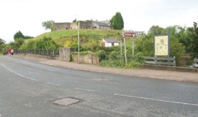
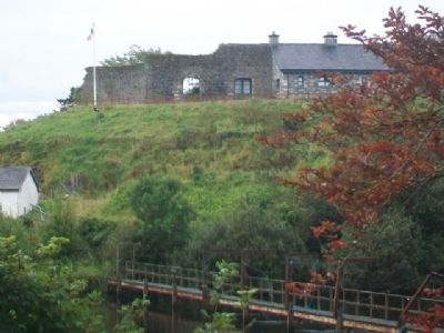
Belleek Fort
On the hill opposite the pottery - it dates from the late 18th century.
Church of Ireland Church
Built in 1809[?] and initially used as a school.
St. Patrick's Catholic Church
Built in 1892.
Crafts
Fermanagh Crystal (at the Craft Village), Heron Ceramics and Celtic Weave.
Activities
Horse riding, bicycle hire, walking tours, cruiser hire.
Erected by International Fund for Ireland, Fermanagh, and Rural Development Council for NI.
Topics. This historical marker is listed in these topic lists: Environment • Industry & Commerce • Man-Made Features • Settlements & Settlers. A significant historical year for this entry is 1610.
Location. 54° 28.755′ N, 8° 5.637′ W. Marker is in Belleek, Northern Ireland, in Fermanagh And Omagh. Marker is at the intersection of Main Street (A47) and the entrance to the Belleek Pottery Factory, on the left when traveling north on Main Street (A47). Marker is on the northern end of the bridge over the River Erne. Touch for map. Marker is at or near this postal address: 3 Main Street, Belleek, Northern Ireland BT93 3FY, United Kingdom. Touch for directions.
Other nearby markers. At least 7 other markers are within 21 kilometers of this marker, measured as the crow flies. Donegal Corridor (a few steps from this marker); The Enamel Grindstone (within shouting distance of this marker); The Franciscan Friary of Donegal (approx. 19.1 kilometers away in Ireland); Donegal Friary / Mainistir Dhún na nGall (approx. 19.1 kilometers away in Ireland); "The Frenchman's Anchor" (approx. 19.3 kilometers away in Ireland); Donegal Castle / Caisleán Dhún na nGall (approx. 19.6 kilometers away in Ireland); Donegal Castle (approx. 19.6 kilometers away in Ireland).
Also see . . . Village of Belleek at YouTube. (Submitted on March 24, 2014, by William Fischer, Jr. of Scranton, Pennsylvania.)
Credits. This page was last revised on August 27, 2020. It was originally submitted on March 24, 2014, by William Fischer, Jr. of Scranton, Pennsylvania. This page has been viewed 961 times since then and 42 times this year. Photos: 1, 2, 3, 4, 5, 6, 7, 8, 9, 10, 11. submitted on March 24, 2014, by William Fischer, Jr. of Scranton, Pennsylvania.
