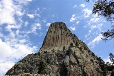
Near Hulett in Crook County, Wyoming — The American West (Mountains)
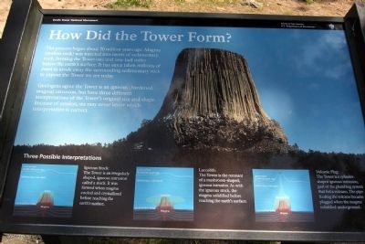
How Did the Tower Form?
Devils Tower National Monument
Geologists agree the Tower is an igneous (hardened magma) intrusion, but have three different interpretations of the Tower’s original size and shape. Because of erosion, we may never know which interpretation is correct.
Three Possible Interpretations
Igneous Stock:
The Tower is an irregularly shaped, igneous intrusion called a stock. It was formed when magma cooled and crystallized before reaching the earth’s surface.
Laccolith:
The Tower is the remnant of a mushroom-shaped, igneous intrusion. As with the igneous stock, the magma solidified before reaching the earth’s surface.
Volcanic Plug:
The Tower is a cylinder-shaped igneous intrusion, part of the plumbing system that fed a volcano. The pipe feeding the volcano became plugged when the magma solidified underground.
Erected by National Park Service.
Topics. This historical marker is listed in this topic list: Notable Places.
Location. 44° 35.427′ N, 104° 43.065′ W. Marker is near Hulett, Wyoming, in Crook County. Marker can be reached from State Highway 110. Marker is located in Devils Tower National Monument; drive to the end of State Route 110 to the parking lot of the Devils Tower Visitor Center. Touch for map. Marker is in this post office area: Hulett WY 82720, United States of America. Touch for directions.
Other nearby markers. At least 8 other markers are within walking distance of this marker. Buried Tower (about 300 feet away, measured in a direct line); Bountiful Land (about 500 feet away); Friends, Family, and Fun (about 500 feet away); Devils Tower ... the first National Monument (about 500 feet away); People of the Land (about 600 feet away); Reach for the Top (approx. 0.2 miles away); Many Meanings for Many People (approx. 0.2 miles away); Daredevil Stunt (approx. ¼ mile away). Touch for a list and map of all markers in Hulett.
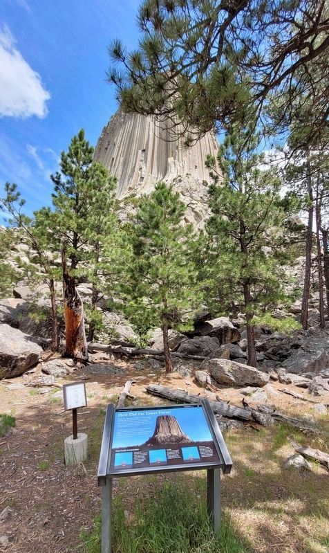
More about this marker. Marker is along the southwest segment of the Tower Trail which circles Devils Tower. It is a 1/4 mile walk from the Visitor Center parking lot to the marker.
Also see . . . Devils Tower National Monument. Official National Park Service website. (Submitted on March 25, 2014.)
Credits. This page was last revised on July 22, 2022. It was originally submitted on March 25, 2014, by Duane Hall of Abilene, Texas. This page has been viewed 1,843 times since then and 198 times this year. Photos: 1. submitted on March 25, 2014, by Duane Hall of Abilene, Texas. 2. submitted on July 22, 2022, by James Hulse of Medina, Texas. 3, 4, 5. submitted on March 25, 2014, by Duane Hall of Abilene, Texas.
