Merritt Island in Brevard County, Florida — The American South (South Atlantic)
Ulumay
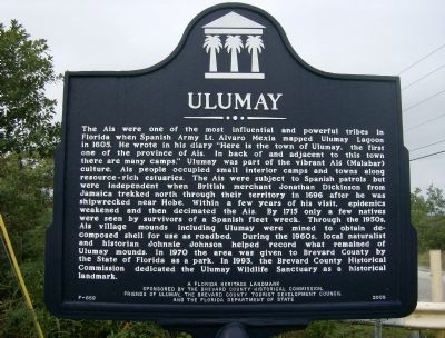
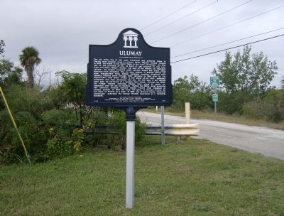
The Ais were one of the most influential and powerful tribes in Florida when Spanish Army Lt. Alvaro Mexia mapped Ulumay Lagoon in 1605. He wrote in his diary “Here is the town of Ulumay, the first one of the province of Ais. In back of and adjacent to this town there are many camps.” Ulumay was part of the vibrant Ais (Malabar) culture. Ais people occupied small interior camps and towns along resource-rich estuaries. The Ais were subject to Spanish patrols but were independent when the British merchant Jonathan Dickinson from Jamaica trekked north through their territory in 1696 after he was shipwrecked near Hobe. Within a few years of his visit, epidemics weakened and then decimated the Ais. By 1715 only a few natives were seen by survivors of a Spanish fleet wreck. Through the 1950’s, Ais village mounds including Ulumay were mined to obtain decomposed shell for use as roadbed. During the 1960’s, local naturalist and historian Johnnie Johnson helped record what remained of Ulumay mounds. In 1970 the area was given to Brevard County by the State of Florida as a park. In 1993, the Brevard County Historical Commission dedicated the Ulumay Wildlife Sanctuary as a historical landmark.
Erected 2009 by Brevard County Historical Commission, Friends of Ulumay, the Brevard County Tourist Development Council and the Florida Department of State. (Marker Number F-659.)
Topics. This historical marker is listed in these topic lists: Colonial Era • Exploration • Native Americans • Settlements & Settlers. A significant historical year for this entry is 1605.
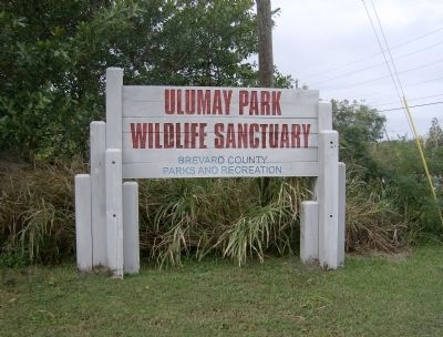
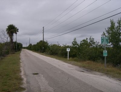
Location. 28° 22.266′ N, 80° 40.804′ W. Marker is on Merritt Island, Florida, in Brevard County. Marker is at the intersection of Sykes Creek Parkway and Old Audubon Road, on the right when traveling south on Sykes Creek Parkway. Marker is located at the entrance to Ulumay Wildlife Sanctuary. Touch for map. Marker is in this post office area: Merritt Island FL 32952, United States of America. Touch for directions.
Other nearby markers. At least 8 other markers are within 2 miles of this marker, measured as the crow flies. Vietnam 1959-1975 (approx. 1.4 miles away); A-7E Carrier-based attack-bomber (approx. 1.4 miles away); War Dogs (approx. 1.4 miles away); September, 11th, 2001 (approx. 1.4 miles away); a different marker also named September, 11th, 2001 (approx. 1.4 miles away); Combat Wounded Veterans (approx. 1.4 miles away); Operation Desert Storm (approx. 1.4 miles away); Korean Veterans Memorial (approx. 1.4 miles away). Touch for a list and map of all markers in Merritt Island.
Credits. This page was last revised on October 9, 2020. It was originally submitted on March 25, 2014, by Cosmos Mariner of Cape Canaveral, Florida. This page has been viewed 1,174 times since then and 66 times this year. Photos: 1. submitted on March 25, 2014, by Cosmos Mariner of Cape Canaveral, Florida. 2, 3, 4. submitted on March 26, 2014, by Cosmos Mariner of Cape Canaveral, Florida. • Bernard Fisher was the editor who published this page.


