Independence in Grayson County, Virginia — The American South (Mid-Atlantic)
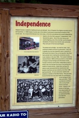
Independence
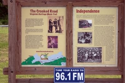
— The Crooked Road — Virginia’s Heritage Music Trail —
Tiny places such as Rugby—too small for maps—have produced notable musicians for generations. Gold Hill is equally tiny, but has a beautiful waltz is named for it. Mill hands from historic Fries on the beautiful New River had a pivotal role in starting the commercial country music industry in the early 1920s. The museum inside the restored Historic 1908 Courthouse presents a cross section of Grayson County heritage and information on the County’s numerous communities. Independence itself is small in size, but has been the home of and setting for a wealth of musical activity. Wade Ward, perhaps the nation’s most renowned old-time clawhammer style banjoist, lived here and was visited by more than 1,000 aspiring banjoists. All were welcomed, inspired, and treated as a member of the Ward family. There are many musical families here who have made rich contributions to the heritage of their state and nation. These contributions continue with an array of jam sessions and local events. Collectors and scholars of the music from distant places, as well as ordinary fans, are welcomed as they have been for generations.
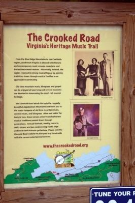
The Crooked Road, Virginia’s Heritage Music Trail. From the Blue Ridge Mountains to the Coalfields region, southwest Virginia is blessed with historic and contemporary music venues, musicians, and fretted instrument makers. Historically isolated, the region retained its strong musical legacy by passing traditions down through musical families to an appreciative community.
Old time mountain music, bluegrass, and gospel can be enjoyed all year long and several museums are devoted to showcasing the area’s rich musical heritage.
The Crooked Road winds through the ruggedly beautiful Appalachian Mountains and leads you to the major hotspots of old time mountain music, country music, and bluegrass. Alive and kickin’ for today’s fans, these venues preserve and celebrate musical traditions passed down through generations. Annual festivals, weekly concerts, radio shows, and jam sessions ring out to large audiences and intimate gatherings. Please visit the Crooked Road website to plan your trip to coincide with the current entertainment events.
Topics and series. This historical marker is listed in these topic lists: Arts, Letters, Music • Entertainment. In addition, it is included in the The Crooked Road: Virginia’s Heritage Music Trail series list. A significant historical year for this entry is 1850.
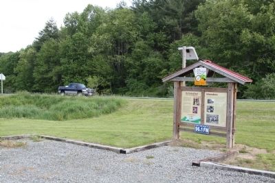
Location. 36° 37.34′ N, 81° 8.091′ W. Marker is in Independence, Virginia, in Grayson County. Marker is at the intersection of East Main Street (U.S. 58) and Morton Drive, on the right when traveling west on East Main Street. Touch for map. Marker is in this post office area: Independence VA 24348, United States of America. Touch for directions.
Other nearby markers. At least 8 other markers are within 7 miles of this marker, measured as the crow flies. The G.A.T.E. Center (approx. 0.9 miles away); Grayson County Confederate Monument (approx. 0.9 miles away); Grayson County Courthouse (approx. 0.9 miles away); a different marker also named Independence (approx. 0.9 miles away); Grayson County War Memorial (approx. 0.9 miles away); Grayson's First Muster Roll While Part of Montgomery County, VA (approx. one mile away); Peyton Guyn Hale (approx. 5.9 miles away); Caty Sage (approx. 6.9 miles away). Touch for a list and map of all markers in Independence.
More about this marker. The Independence panel shows three photographs captioned “Annual Independence Day Celebration,” “Wade Ward,” and “Confederate Veterans.” The Crooked Road panel shows The Carter Family on the upper right, Dr. Ralph Stanley in the center right and a map of western Virginia showing stops on The Crooked Road and “You are Here.”
Also see . . . Leroy Troy playing a clawhammer banjo. 2013 video on Bluegrass Today website. (Submitted on March 26, 2014.)
Credits. This page was last revised on June 16, 2016. It was originally submitted on March 26, 2014, by J. J. Prats of Powell, Ohio. This page has been viewed 592 times since then and 24 times this year. Photos: 1, 2, 3, 4. submitted on March 26, 2014, by J. J. Prats of Powell, Ohio.


