Lisnaskea in Fermanagh And Omagh, Northern Ireland, United Kingdom — Northwestern Europe (the British Isles)
Lisnaskea Market Cross
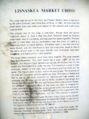
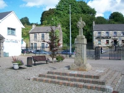
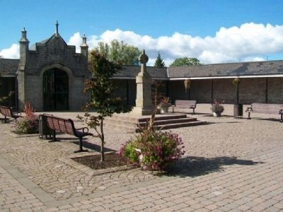
This cross was set up in the Corn and Potato Market when it was built by Mr John Crichton, later third Earl of Erne, in 1841. At that time the small stone cross was made and placed on the ancient and much more massive shaft.
The original site of the cross is unknown, though there are several traditions about it. One is that the shaft formerly stood at Fawney cross-roads, east of Lisnaskea, and was used for swearing oaths. The base is said to have been dug up somewhere near the town, or used as a mounting block at Castle Balfour. Lisnaskea itself is not the site of an early church, and the likelihood is that the cross once stood at one of the early church sites in the area. Galloen and Inishroosk have been suggested, and Aghalurcher is also possible.
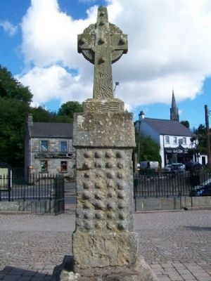
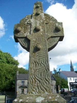
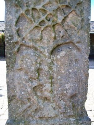
The cross when complete must have been massive. The large stepped case is undecorated. The shaft above has a plain 'collar' at top and bottom, but the main faces between are carved. On the east face (to the street) are Adam and Eve under the tree. The treatment is bold in scale and lively. Adam, to the right, has a long beard, and Eve holds out the apple. The figures seem to skip: notice the bent knees. The branches of the tree are interlaced, and the apples are clear. The scene of Adam and Eve is one of the most common on figure-carved high crosses, and examples not far away can be seen at Boho, Drumcliff (Co Sligo) and Clones (Co Monaghan). On the west face are thirty-two circular bosses. To complete the original form of the cross you have to imagine the shaft continuing above the top collar (joined with a mortice and tenon joint), running into a large cross head, probably of the ringed form. The cross is not easy to date closely, but the 10th century is possible.
The cross was published by Lady Dorothy Lowry-Corry in the Journal of the Royal Society of Antiquaries of Ireland 65 (1935). It was moved from a site close to the railings into the middle of the Market as part of the restoration scheme carried out in 1980-81.
The Market including the Cross is listed for protection under the Planning (Northern Ireland) Order 1972. This notice was supplied by Historic Monuments and Buildings Branch (DOENI) in 1985.
Erected 1985 by Historic Monuments and Buildings Branch (DOENI).
Topics. This historical marker is listed in these topic lists: Churches & Religion • Education • Settlements & Settlers. A significant historical year for this entry is 1841.
Location. 54° 15.175′ N, 7° 26.598′ W. Marker is in Lisnaskea, Northern Ireland, in Fermanagh And Omagh. Marker is on Main Street (A34), on the left when traveling north
. Marker and High Cross are on the old Corn and Potato Market Square. Touch for map. Marker is at or near this postal address: 141 Main Street, Lisnaskea, Northern Ireland BT92 0JE, United Kingdom. Touch for directions.
Other nearby markers. At least 7 other markers are within 18 kilometers of this marker, measured as the crow flies. Castle Balfour (approx. 0.4 kilometers away); World Wars Memorial (approx. 16 kilometers away); Cole's Monument (approx. 16.1 kilometers away); South Africa War Memorial (approx. 16.6 kilometers away); German 21cm Mortar, 1918 (approx. 16.7 kilometers away); The Watergate and Flag of St George (approx. 16.7 kilometers away); German 77mm Light Artillery Gun (approx. 16.7 kilometers away).
Also see . . . Lisnaskea High Cross. (Submitted on March 29, 2014, by William Fischer, Jr. of Scranton, Pennsylvania.)
Credits. This page was last revised on September 6, 2022. It was originally submitted on March 29, 2014, by William Fischer, Jr. of Scranton, Pennsylvania. This page has been viewed 528 times since then and 9 times this year. Photos: 1, 2, 3, 4, 5, 6. submitted on March 29, 2014, by William Fischer, Jr. of Scranton, Pennsylvania.
