St. Simons Island in Glynn County, Georgia — The American South (South Atlantic)
The Military Road
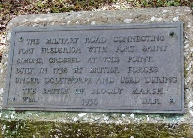
Inscription.
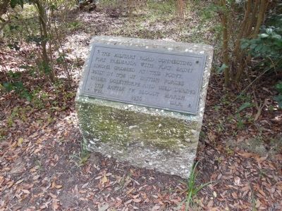
The Military Road connecting Fort Frederica with Fort Saint Simons, crossed at this point. Built in 1738 by British forces under Oglethorpe and used during the Battle of Bloody Marsh.
W.P.A. 1936 D.A.R.
Erected 1936 by Works Progress Administration and the Daughters of the American Revolution.
Topics and series. This historical marker is listed in these topic lists: Colonial Era • Forts and Castles • Roads & Vehicles • Settlements & Settlers. In addition, it is included in the Daughters of the American Revolution, and the Works Progress Administration (WPA) projects series lists. A significant historical year for this entry is 1738.
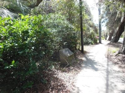
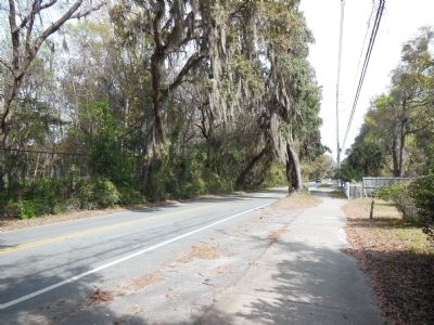
Location. 31° 12.629′ N, 81° 22.531′ W. Marker is on St. Simons Island, Georgia, in Glynn County. Marker is on Frederica Road, 0.2 miles north of South Harrington Road, on the right when traveling north. The marker is short and somewhat hidden by trees and undergrowth making it difficult to see from the street, even though only a few feet off Frederica Road. Touch for map. Marker is in this post office area: Saint Simons Island GA 31522, United States of America. Touch for directions.
Other nearby markers. At least 8 other markers are within one mile of this marker, measured as the crow flies. Battle of Gully Hole Creek (approx. ¾ mile away); Harrington Hall (approx. 0.9 miles away); Christ Church Cemetery (approx. 0.9 miles away); The Wesley Oak (approx. 0.9 miles away); Christ Episcopal Church (approx. 0.9 miles away); Reverends John & Charles Wesley / Wesley Memorial Garden (approx. one mile away); William Bartram Trail (approx. one mile away); The Georgia Navy (approx. one mile away). Touch for a list and map of all markers in St. Simons Island.
Also see . . .
1. Battle of Bloody Marsh. On July 7, 1742, English and Spanish forces skirmished on St. Simons Island in an encounter later known as the Battle of Bloody Marsh. This event was the only Spanish attempt to invade Georgia during the War of Jenkin's Ear. (Submitted on March 30, 2014, by Cosmos Mariner of Cape Canaveral, Florida.)
2. The Battle of Bloody Marsh. The Battle of Bloody Marsh took place on July 18, 1742 between Spanish and British forces on St. Simons Island, part of the Province of Georgia, resulting in a victory for the British. Part of a much larger conflict known as the War of Jenkins' Ear, the battle was for the British fortifications of Fort Frederica and Fort St. Simons, with the strategic goal the sea routes and inland waters they controlled. (Submitted on March 30, 2014, by Cosmos Mariner of Cape Canaveral, Florida.)

Photographed By Cosmos Mariner, March 21, 2013
3. The Military Road Marker (sidewalk view)
Wide view of marker, sidewalk, and Frederica Road looking south. The marker is somewhat hidden from the road by trees and undergrowth. The marker is more likely to be noticed by pedestrians and cyclists than by vehicle drivers.
Credits. This page was last revised on November 25, 2020. It was originally submitted on March 30, 2014, by Cosmos Mariner of Cape Canaveral, Florida. This page has been viewed 972 times since then and 41 times this year. Photos: 1, 2, 3, 4. submitted on March 30, 2014, by Cosmos Mariner of Cape Canaveral, Florida. • Bernard Fisher was the editor who published this page.


