Downtown Oakland in Alameda County, California — The American West (Pacific Coastal)
Oakland City Hall
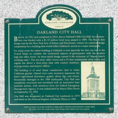
Begun in 1911 and completed in 1914, this is Oakland’s fifth City Hall. Its construction was funded with a $1.15 million bond issue passed in 1909. The Beaux Arts design was by the New York firm of Palmer and Hornbostel, winners of a national design competition for a building that would reflect Oakland’s arrival as a major metropolis.
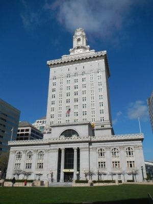
For many years the tallest building in Oakland, it was reputedly the first city hall in the United States to combine the ceremonial aspects of government with the modern high-rise office tower. Its three-tiered design earned it the nickname of “Mayor Mott’s wedding cake.” The ten-story office tower and a 91-foot ornamental clock tower and cupola rise above a three-story base with the council chambers, hearing rooms and mayor’s offices.
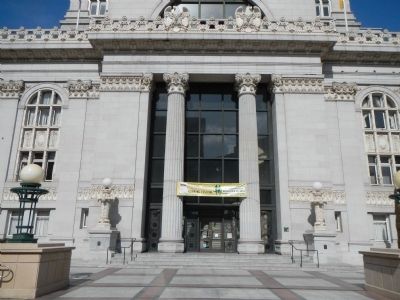
The building is of steel frame construction clad in white California granite. Glazed terra cotta ornament represents the state’s agricultural abundance: grapes, olives, figs, and wheat. Structurally damaged in the 1989 earthquake, City Hall was completely renovated and retrofitted with an innovative base isolation system, with assistance from the Federal Emergency Management Agency. It was rededicated by Mayor Elihu Harris on September 15, 1995.
City Hall was designated an Oakland City Landmark in 1979 and listed on the National Register of Historic Places in 1983.
Erected by City of Oakland and Oakland Heritage Alliance. (Marker Number 28.)
Topics. This historical marker is listed in these topic lists: Government & Politics • Notable Buildings. A significant historical month for this entry is September 1946.
Location. 37° 48.316′ N, 122° 16.337′ W. Marker is in Oakland, California, in Alameda County. It is in Downtown Oakland. Marker can be reached from Frank H Ogawa Plaza near 14th Street. Touch for map. Marker is at or near this postal address: 1 Frank H Ozawa Plaza, Oakland CA 94612, United States of America. Touch for directions.
Other nearby markers. At least 8 other markers are within walking distance of this marker. 1946 General Strike (about 300 feet away, measured in a direct line); Latham Memorial Fountain Unveiled (about 500 feet away); Crossroads (about 500 feet away); General Strike! (about 500 feet away); Uptown Saturday Night (about 500 feet away); Latham Square (about 500 feet away); The Lathams (about 500 feet away); Breonna Taylor (about 600 feet away). Touch for a list and map of all markers in Oakland.
Also see . . . Oakland City Hall. Oakland Wiki website entry:
On October 13, 1911, President William Howard Taft laid the cornerstone for the new city hall. When city hall first opened, it included a jail (complete with outside exercise area), a fire station, a police station, and a small hospital. Today it houses a variety
of city offices, as well as various chambers used for city council meetings and other city meetings. (Submitted on March 31, 2014, by Barry Swackhamer of Brentwood, California.)
Credits. This page was last revised on February 7, 2023. It was originally submitted on March 31, 2014, by Barry Swackhamer of Brentwood, California. This page has been viewed 822 times since then and 39 times this year. Photos: 1, 2, 3. submitted on March 31, 2014, by Barry Swackhamer of Brentwood, California. • Bill Pfingsten was the editor who published this page.


