Brightwood in Northwest Washington in Washington, District of Columbia — The American Northeast (Mid-Atlantic)
What a Beautiful Location, Brightwood
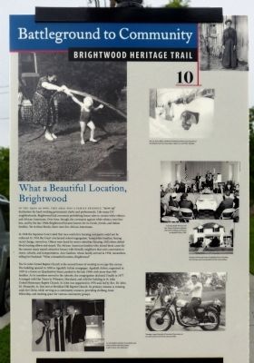
Battleground to Community
— Brightwood Heritage Trail —
In the 1930s as now, this area was a family friendly, "move-up" destination for hard-working government clerks and professionals. Like many DC neighborhoods, Brightwood had covenants prohibiting sales to certain white ethnics and African Americans. Over time, though, the covenants against white ethnics were broken, and by the late 1940s Brightwood became known for its Greek, Jewish, and Italian families. Yet in these blocks were few African Americans.
In 1948 the Supreme Court ruled that race-restrictive housing covenants could not be enforced. In 1954 the Court overturned school segregation. Some white families, fearing racial change, moved on. Others were lured by newer suburban housing. Still others defied block busting efforts and stayed. The African American families who joined them came for the reasons many stayed: attractive houses with friendly neighbors that were convenient to stores, schools, and transportation. Ann Gardener, whose family arrived in 1958, remembers telling her husband, "What a beautiful location, Brightwood."
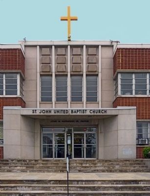
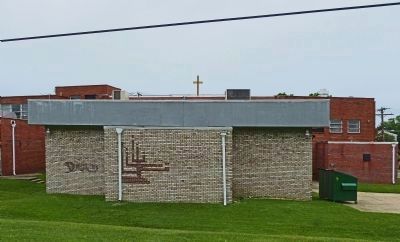
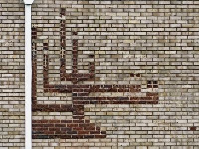
The St. John United Baptist Church is the second house of worship to occupy this corner. The building opened in 1958 as Agudath Achim synagogue. Agudath Achim, organized in 1939 in a house on Quackenbos Street, peaked in the late 1950s with more than 400 families. As its members moved to the suburbs, the congregation declined. Finally in 1977 it merged with Har Tzeon in Wheaton, Maryland, and sold the building to St. John United Missionary Baptist Church. St. John was organized in 1976 and, led by Rev. Dr. John M. Alexander, Jr., first met at Meridian Hill Baptist Church, its primary mission is winning souls for Christ, while serving as a community resource, providing clothing, food, fellowship, and meeting space for various community groups.
Erected by Cultural Heritage DC. (Marker Number 10.)
Topics and series. This historical marker is listed in these topic lists: African Americans • Churches & Religion • Civil Rights • Education • Settlements & Settlers. In addition, it is included in the Brightwood Heritage Trail series list. A significant historical year for this entry is 1948.
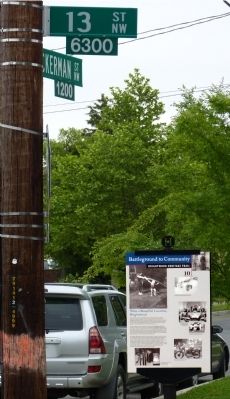
Location. 38° 58.059′ N, 77° 1.774′ W. Marker is in Northwest Washington in Washington, District of Columbia. It is in Brightwood. Marker is at the intersection of Tuckerman Street Northwest and 13th Street Northwest, on the right when traveling east on Tuckerman Street Northwest. Touch for map. Marker is at or near this postal address: 1225 Tuckerman Street Northwest, Washington DC 20012, United States of America. Touch for directions.
Other nearby markers. At least 8 other markers are within walking distance of this marker. St. John United Baptist Church (within shouting distance of this marker); The Seventh Street Turnpike (about 500 feet away, measured in a direct line); Automobiling on The Avenue (about 800 feet away); Never Again Such Homes At the Price! (approx. 0.2 miles away); Lincoln Under Fire at Fort Stevens (approx. 0.2 miles away); Scale Model of Fort Stevens (approx. ¼ mile away); Fort Stevens (approx. ¼ mile away); Battleground National Cemetery (approx. ¼ mile away). Touch for a list and map of all markers in Northwest Washington.
Also see . . . Brightwood Heritage Trail. Cultural Tourism DC website entry (Submitted on April 5, 2014, by Allen C. Browne of Silver Spring, Maryland.)
Credits. This page was last revised on January 30, 2023. It was originally submitted on April 5, 2014, by Allen C. Browne of Silver Spring, Maryland. This page has been viewed 934 times since then and 18 times this year. Photos: 1, 2, 3, 4, 5. submitted on April 5, 2014, by Allen C. Browne of Silver Spring, Maryland. • Bill Pfingsten was the editor who published this page.
Editor’s want-list for this marker. A photo of the marker reverse. • Can you help?
