Near Purcellville in Loudoun County, Virginia — The American South (Mid-Atlantic)
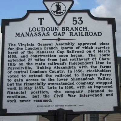
Loudoun Branch, Manassas Gap Railroad
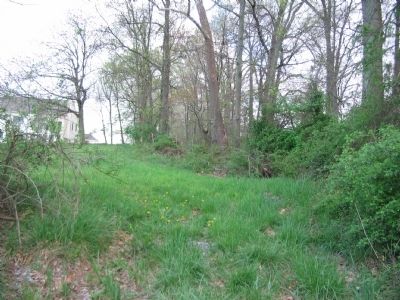
The Virginia General Assembly approved plans for the Loudoun Branch (parts of which survive here) of the Manassas Gap Railroad on 8 March 1853, and construction soon began. The route extended 27 miles from just southwest of Chantilly on the main railroad's independent line to Purcellville, linking Alexandria with the farms of central Loudoun County. In 1856, stockholders voted to extend the railroad to Harpers Ferry to gain access to the lower Shenandoah Valley, but the financially overextended company stopped work in May 1857. Late in 1860, with an improved financial position, the company planned to continue, but the Civil War intervened and work never resumed.
Erected 2005 by Department of Historic Resources. (Marker Number T-53.)
Topics and series. This historical marker is listed in this topic list: Railroads & Streetcars. In addition, it is included in the Manassas Gap Railroad, and the Virginia Department of Historic Resources (DHR) series lists. A significant historical date for this entry is March 8, 1853.
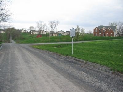
Location. 39° 7.316′ N, 77° 41.049′ W. Marker is near Purcellville, Virginia, in Loudoun County. Marker is at the intersection of Sands Road (County Route 709) and Manassas Gap Court, on the right when traveling east on Sands Road. Touch for map . Marker is in this post office area: Purcellville VA 20132, United States of America. Touch for directions.
Other nearby markers. At least 8 other markers are within 2 miles of this marker, measured as the crow flies. Goose Creek Friends (approx. ¾ mile away); Goose Creek Friends 1817 Meeting House (approx. ¾ mile away); Goose Creek Friends 1765 Meeting House (approx. ¾ mile away); Goose Creek Historic District (approx. 0.8 miles away); Goose Creek Friends Oakdale School (approx. 0.8 miles away); Mother of the Wright Brothers (approx. 1.1 miles away); Mahlon Taylor Springhouse (approx. 1.2 miles away); Major General Ben H. Fuller (approx. 1.3 miles away). Touch for a list and map of all markers in Purcellville.
Also see . . .
1. Manassas Gap Railroad Independent Line. Virginia Department of Historic Resources website entry (Submitted on April 22, 2008, by Craig Swain of Leesburg, Virginia.)
2. Loudoun Branch of the Manassas Gap Railroad. Several sections of road bed and at least one tunnel relating to the railroad still exist today. (Submitted on April 22, 2008, by Craig Swain of Leesburg, Virginia.)
Credits. This page was last revised on April 10, 2022. It was originally submitted on April 22, 2008, by Craig Swain of Leesburg, Virginia. This page has been viewed 2,321 times since then and 44 times this year. Photos: 1, 2, 3. submitted on April 22, 2008, by Craig Swain of Leesburg, Virginia.


