Colwood in Capital, British Columbia — Canada’s West Coast (North America)
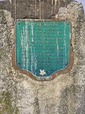
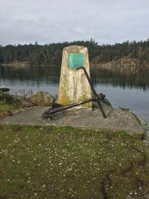
Royal Roads
Erected 1972 by Thermopylae Club.
Topics. This historical marker is listed in these topic lists: Disasters • Waterways & Vessels. A significant historical month for this entry is April 1940.
Location. 48° 25.773′ N, 123° 27.513′ W. Marker is in Colwood, British Columbia, in Capital. Marker is on Ocean Boulevard, on the right when traveling south. Touch for map. Marker is in this post office area: Colwood BC V9C, Canada. Touch for directions.
Other nearby markers. At least 8 other markers are within walking distance of this marker. Defence Electric Light Directing Station (approx. 0.4 kilometers away); Gun Emplacement / Emplacement du canon (approx. half a kilometer away); The Victoria and Esquimalt Coast Defences (approx. half a kilometer away); Defensible Wall / Mur défensif (approx. half a kilometer away); The Guardhouse / Corps de garde (approx. half a kilometer away); Upper Battery / Batterie supérieure (approx. half a kilometer away); Fisgard Lighthouse National Historic Site (approx. half a kilometer away); Upper, Lower, Belmont Batteries (approx. 0.6 kilometers away).
Credits. This page was last revised on June 16, 2016. It was originally submitted on December 27, 2013, by Andrew Lester of Victoria, BC, Canada. This page has been viewed 516 times since then and 9 times this year. Last updated on April 7, 2014, by Barry Swackhamer of Brentwood, California. Photos: 1, 2. submitted on December 27, 2013, by Andrew Lester of Victoria, BC, Canada. • Bill Pfingsten was the editor who published this page.

