Niagara Falls in Niagara County, New York — The American Northeast (Mid-Atlantic)
The Great Cataract of Niagara
An attraction even in wartime
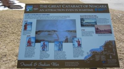
Early European Visitors
The Niagara River, with its mighty falls and rapids, was well known by Native Americans. Word of its majesty reached European explorers and soldiers who came to North America. Despite their mission, explorers and soldiers alike took time to see the watery spectacles for themselves.
1615 Etienne Brule, a French explorer may have been the first European to actually view the Falls and gorge.
1678 French explorer La Salle passed through here on his way to survey the Great Lakes. Along on the trip was Louis Hennepin published the first engraving of Niagara Falls in his book Nouvelle Decouverte.
1720 French fur trader Chabert Joncaire established a trading post at the lower portage landing at the foot of the gorge and likely guided many early visitors to the Falls.
1750 French soldiers stationed at Fort Niagara at the mouth of the Niagara River were in a good position to visit the Falls regularly. Two French officers from Fort Niagara escorted Peter Kalm, a Swedish botanist and agriculturalist, to the Falls.
1759 After the English captured Fort Niagara, they had access to the Falls as well. General Sir William Johnson, Colonel Frederick Haldimand, Reverend John Ogilvie, and several other officers were escorted by three companies of light infantry "...to see Niagara Falls."
1760 Thomas Davies was one of the first to illustrate views of the Falls. Davies created this image entitled "An East View of the Great Cataract of Niagara" while on a survey for Major General Jeffery Amherst.
Illustrator of the French & Indian War
British Artilleryman and officer Thomas Davies illustrated these and many other scenes during the French & Indian War. Artists were an important part of an organized army; their skills of observation were used to document places and events.
French & Indian War. The first Europeans visited the natural attractions of the Great Lakes Seaway Trail. Seaway Trail, Inc. Corner Ray & West Mail St., Sackets Harbor, NY 13685. www.seawaytrail.com . America's Byways. This project was funded in part by the Federal Highway Administration and administered by the New York State Scenic Byways Program of the New York State Department of Transportation and Seaway Trail, Inc.
Erected by Seaway Trail, Inc.
Topics and series. This historical marker is listed in these topic lists: Exploration • War, French and Indian. In addition, it is included in the Great Lakes Seaway Trail National Scenic Byway series list. A significant historical year for this entry is 1615.
Location. 43° 4.659′ N, 79° 0.978′ W. Marker is in Niagara
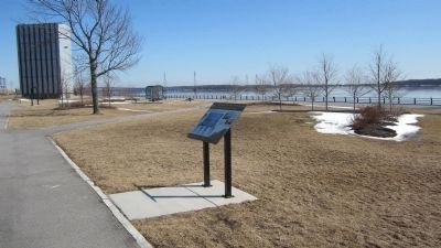
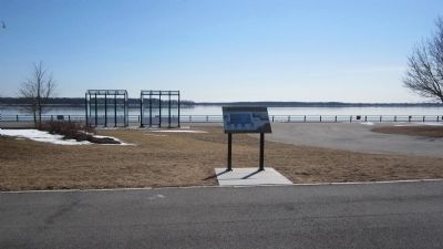
Falls, New York, in Niagara County. Marker can be reached from Niagara Scenic Parkway (New York State Route 957A) one mile north of Interstate 190. The Marker, and the Fort Schlosser marker, are located at a scenic overlook of the upper Niagara River where the two New York State Power Authority water intake portal gates are located. The gates are housed in towers. The overlook is accessible by car only from the parkway. The parkway divider is cut to allow traffic to cross to and from the overlook area. Though marked north-south, this stretch of the parkway is compass east-west. The parkway was renamed. The original name was Robert Moses Parkway. Touch for map. Marker is in this post office area: Niagara Falls NY 14304, United States of America. Touch for directions.
Other nearby markers. At least 8 other markers are within 2 miles of this marker, measured as the crow flies. Fort Schlosser (about 300 feet away, measured in a direct line); Portage Road (approx. 1.3 miles away); Niagara Falls Veterans Memorial (approx. 1.3 miles away); The Niagara River Portage and the Old Stone Chimney (approx. 1˝ miles away); Historic Falls Portage (approx. 1˝ miles away); Old Stone Chimney (approx. 1˝ miles away); Thomas V. Welch (approx. 1˝ miles away); Holy Trinity Roman Catholic Church Complex (approx. 1˝ miles away). Touch for a list and map of all markers in Niagara Falls.
More about this marker. GPS coordinates are for the Niagara Scenic Parkway by the western
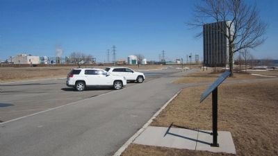
Photographed By Anton Schwarzmueller, March 31, 2014
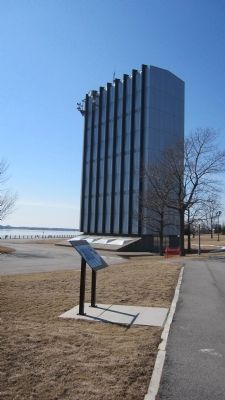
3. Eastward Parking Lot View of The Great Cataract of Niagara Marker
Chemical Plants in the background use energy from the New York Power Authority's Niagara Power Plant (hydro power); from here the underground water tunnels carry water from the upper Niagara River to the generating plant downriver.
Also see . . .
1. Niagara Power Vista. NY Power Authority website entry (Submitted on April 10, 2014, by Anton Schwarzmueller of Wilson, New York.)
2. Thomas Davies. Wikipedia entry (Submitted on April 10, 2014, by Anton Schwarzmueller of Wilson, New York.)
Credits. This page was last revised on June 27, 2023. It was originally submitted on April 10, 2014, by Anton Schwarzmueller of Wilson, New York. This page has been viewed 700 times since then and 28 times this year. Last updated on June 24, 2023, by Trevor L Whited of Kokomo, Indiana. Photos: 1, 2, 3, 4, 5. submitted on April 10, 2014, by Anton Schwarzmueller of Wilson, New York. • Michael Herrick was the editor who published this page.
