Bethesda in Montgomery County, Maryland — The American Northeast (Mid-Atlantic)
Locust Grove
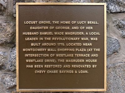
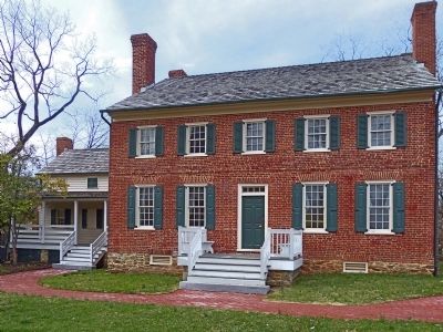
Locust Grove, the home of Lucy Beall, daughter of George, and of her husband Samuel Wade Magruder, a local leader in the Revolutionary War, was built around 1770. Located near Montgomery Mall Shopping Plaza (at the intersection of Westlake Terrace and Westlake Drive), The Magruder House has been restored and renovated by Chevy Chase Savings & Loan.
Topics. This historical marker is listed in these topic lists: Settlements & Settlers • War, US Revolutionary • Women. A significant historical year for this entry is 1770.
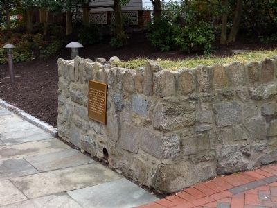
Location. 38° 59.208′ N, 77° 5.876′ W. Marker is in Bethesda, Maryland, in Montgomery County. Marker is on Old Georgetown Road (Maryland Route 187) just east of Fairmont Avenue, on the right when traveling east. Marker is on the retaining wall just east of Mrs. Withers House. Touch for map. Marker is at or near this postal address: 7740 Old Georgetown Rd, Bethesda MD 20814, United States of America. Touch for directions.
Other nearby markers. At least 8 other markers are within walking distance of this marker. This Complex of Buildings and Gardens (a few steps from this marker); Old Georgetown Road (within shouting distance of this marker); Tennallytown and Rockville Railroad (within shouting distance of this marker); a different marker also named Old Georgetown Road (about 300 feet away, measured in a direct line); Looking North up Wisconsin Avenue at Old Georgetown Road in 1940 (about 500 feet away); Veterans Memorial (about 800 feet away); Robert W. Lebling (approx. ¼ mile away); Five Points, historic crossroads (approx. ¼ mile away). Touch for a list and map of all markers in Bethesda.
More about this marker. This marker is miles away from the house it describes. It is in front of the Withers House, the home of Virginia Lee Beall Withers who stood in the way of Bethesda development by refusing to sell her property and eventually struck a deal that allowed development to envelope her house buffered by a small urban park.
Related marker. Click here for another marker that is related to this marker. Home of Samuel Wade Magruder, 1728-1792
Also see . . .
1. The House Magruder Built. Washington Post article, February 5, 1985 (Submitted on March 18, 2022, by Larry Gertner of New York, New York.)
2. Virginia Withers, Fought Efforts To Develop Bethesda Property, 85. Google Groups entry:
Obituary, 2002. (Submitted on April 4, 2014, by Allen C. Browne of Silver Spring, Maryland.)
Photographed By Allen C. Browne, April 2, 2014
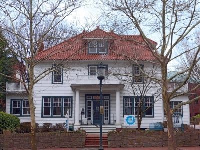
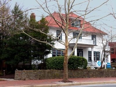
4. Mrs. Withers' House
"Leslie W. Beall, one of the first grocers in the Bethesda area, built this two-and-a-half story frame, American Four Square house with Colonial Revival features and a tile roof in 1925. Mrs. Withers is Leslie Beall’s daughter." -- Bethesda Briefing Book, 2014.
Credits. This page was last revised on January 4, 2023. It was originally submitted on April 4, 2014, by Allen C. Browne of Silver Spring, Maryland. This page has been viewed 893 times since then and 47 times this year. Last updated on April 12, 2014, by Keith S Smith of West Chester, Pennsylvania. Photos: 1, 2, 3, 4, 5. submitted on April 4, 2014, by Allen C. Browne of Silver Spring, Maryland. • Bill Pfingsten was the editor who published this page.
