Brigham in Iowa County, Wisconsin — The American Midwest (Great Lakes)
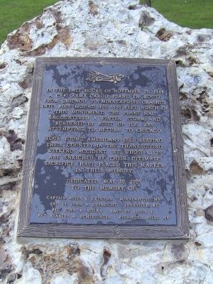
Army Cargo Plane Crash
Four young Americans died serving their country in the Thanksgiving weekend accident. We, whose lives are enriched by their ultimate sacrifice, have placed this marker in their memory.
Dedicated May 30, 2005 to the memory of:
Captain Allen L. Swinton, Minneapolis, MN
2nd Lt. John A. Oppreicht, Lynxville, WI
Pfc. John B. Nolan, East St. Louis, IL
Pvt. Stanley A. Schlesinger, Richmond Hills, NY
Erected 2005.
Topics. This memorial is listed in these topic lists: Air & Space • War, World II. A significant historical date for this entry is November 25, 1944.
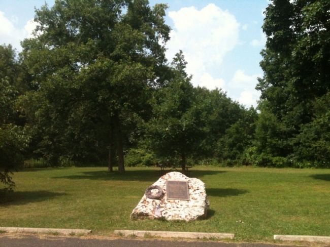
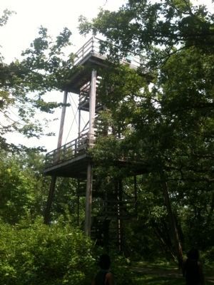
Location. 43° 1.701′ N, 89° 51.033′ W. Marker is in Brigham, Wisconsin, in Iowa County. Memorial can be reached from Mounds Road/ Park Entrance Road, 1˝ miles north of County Road Id (County Route Id). Marker is located near the east (observation) tower in Blue Mounds State Park. From US route 151/18, exit north at County Road F, turn left onto County Road Id, then right onto Mounds Road and through the village of Blue Mounds. See link for a map of the park. The park road ends in a loop with observation towers east and west. The GPS coordinates are for the loop. Touch for map. Marker is in this post office area: Blue Mounds WI 53517, United States of America. Touch for directions.
Other nearby markers. At least 8 other markers are within 7 miles of this marker, measured as the crow flies. Blue Mounds Fort (approx. 1˝ miles away); Brigham Park (approx. 1.6 miles away); a different marker also named Brigham Park (approx. 1.6 miles away); Site of Blue Mounds Fort (approx. 1.9 miles away); Elvers Corner (approx. 3.9 miles away); German Valley (approx. 4˝ miles away); Peculiar Corners (approx. 5.7 miles away); Old Town (approx. 6.2 miles away).
More about this marker. Where the road loops, and the towers are located, is the largest hill in the southern part of state of Wisconsin. The park road crosses into Iowa County from Dane County and on to the loop/summit.
Also see . . .
1. Wisconsin State Park System - Blue Mound State Park. (Submitted on March 30, 2014, by Anton Schwarzmueller of Wilson, New York.)
2. Wikipedia - Blue Mound State Park. (Submitted on March 30, 2014, by Anton Schwarzmueller of Wilson, New York.)
3. Aviation Safety Network. Crash, flight, and aircraft data for the accident. (Submitted on March 30, 2014, by Anton Schwarzmueller of Wilson, New York.)
Credits. This page was last revised on December 7, 2021. It was originally submitted on March 30, 2014, by Anton Schwarzmueller of Wilson, New York. This page has been viewed 2,018 times since then and 110 times this year. Last updated on April 15, 2014, by Anton Schwarzmueller of Wilson, New York. Photos: 1. submitted on March 30, 2014, by Anton Schwarzmueller of Wilson, New York. 2, 3. submitted on August 3, 2014, by William J. Toman of Green Lake, Wisconsin. 4. submitted on January 24, 2015, by William J. Toman of Green Lake, Wisconsin. • Bill Pfingsten was the editor who published this page.


