Big Spring in Howard County, Texas — The American South (West South Central)
Big Spring State Park on Route of Old Comanche War Trail
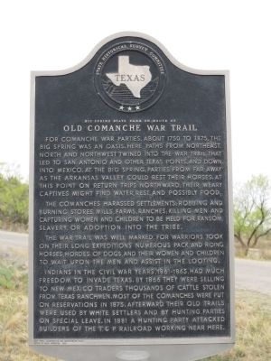
Inscription.
For Comanche war parties, about 1750 to 1875, the Big Spring was an oasis. Here paths from northeast, north and northwest twined into the War Trail that led to San Antonio and other Texas points, and down into Mexico. At the Big Spring, parties from far away as the Arkansas Valley could rest their horses. At this point on return trips northward, their weary captives might find water, rest, and possibly food.
The Comanches harassed settlements, robbing and burning stores, mills, farms, ranches; killing men and capturing women and children to be held for ransom, slavery, or adoption into the tribe.
The War Trail was well marked, for warriors took on their long expeditions numerous pack and riding horses, hordes of dogs, and their women and children to wait upon the men and assist in the looting.
Indians in the Civil War years, 1861-1865, had much freedom to invade Texas. By 1866 they were selling to New Mexico traders thousands of cattle stolen from Texas ranchmen. Most of the Comanches were put on reservations in 1875. Afterward their old trails were used by white settlers and by hunting parties on special leave. In 1881 a hunting party attacked builders on the T. & P. Railroad working near here. Incise on base: Early travel, communication and transportation series
Erected by Moody Foundation 1966
Erected 1966 by State Historical Survey Committee and the Moody Foundation. (Marker Number 12670.)
Topics and series. This historical marker is listed in this topic list: Native Americans. In addition, it is included in the Comanche Trail into Mexico series list. A significant historical year for this entry is 1750.
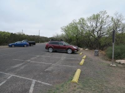
Location. 32° 13.762′ N, 101° 28.904′ W. Marker is in Big Spring, Texas, in Howard County. Marker can be reached from State Park Road 8 west of West Marcy Drive (County Route 700), on the right when traveling west. Marker is located in parking area at the entrance to Big Spring State Park. Touch for map. Marker is in this post office area: Big Spring TX 79720, United States of America. Touch for directions.
Other nearby markers. At least 8 other markers are within 2 miles of this marker, measured as the crow flies. Route of Marcy’s Trail (approx. 0.8 miles away); First Christian Church (approx. 1˝ miles away); Big Spring School District (approx. 1˝ miles away); First National Bank in Big Spring (approx. 1˝ miles away); Howard County (approx. 1.6 miles away); Potton House (approx. 1.6 miles away); Settles Hotel (approx. 1.7 miles away); The Seventh Earl of Aylesford (approx. 1.7 miles away). Touch for a list and map of all markers in Big Spring.
Related marker. Click here for another marker that is related to this marker.
Also see . . .
Big Spring State Park. Texas Parks and Wildlife Department (Submitted on April 30, 2014.)

Photographed By Richard Denney
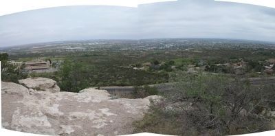
3. Panorama from Scenic Mountain
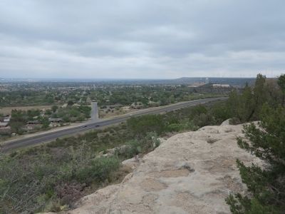
Gelo & Pate in their book, Texas Indian Trails, relate that Comanche elders today recall ancestors approaching from the north knew to look for two hills rising on either side of the springs (Big Springs). Those hills are now called South Mountain and Scenic Mountain, the latter now being part of Big Springs State Park. Panorama is from top of Scenic Mountain.
Credits. This page was last revised on June 16, 2016. It was originally submitted on April 29, 2014, by Richard Denney of Austin, Texas. This page has been viewed 935 times since then and 44 times this year. Photos: 1, 2, 3, 4. submitted on April 29, 2014, by Richard Denney of Austin, Texas. • Bernard Fisher was the editor who published this page.


