Ashford in Houston County, Alabama — The American South (East South Central)
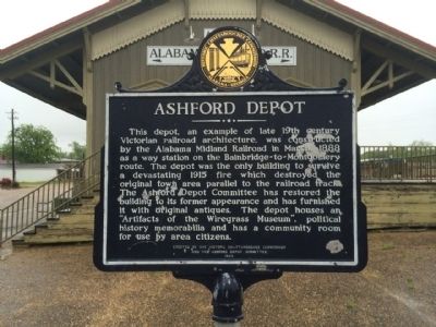
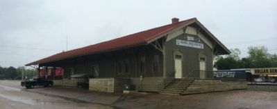
Ashford Depot
Erected 1989 by the Historic Chattahoochee Commission and the Ashford Depot Committee.
Topics. This historical marker is listed in this topic list: Railroads & Streetcars. A significant historical month for this entry is March 1888.
Location. 31° 11.006′ N, 85° 14.258′ W. Marker is in Ashford, Alabama, in Houston County. Marker is at the intersection of 3rd Avenue and Midland Street, on the right when traveling north on 3rd Avenue. Touch for map. Marker is at or near this postal address: 301 Midland Street, Ashford AL 36312, United States of America. Touch for directions.
Other nearby markers. At least 8 other markers are within 10 miles of this marker, measured as the crow flies. Ashford Centennial (about 500 feet away, measured in a direct line); Incorporation of Ashford/Ashford - a Unique Name (about 600 feet away); Ashford United Methodist Church (approx. ¼ mile away); Liberty Baptist Church (approx. 3.9 miles away); Cowarts Baptist Church / Cowarts School (approx. 4.2 miles away); Gordon Cemetery / Early Gordon Leaders (approx. 8.3 miles away); Gordon Baptist Church (approx. 8.7 miles away); Cherry Street African Methodist Episcopal Church (approx. 9.4 miles away). Touch for a list and map of all markers in Ashford.
Also see . . . Alabama Midland Railroad Depot and Museum. Encyclopedia of Alabama entry. (Submitted on May 2, 2014, by Mark Hilton of Montgomery, Alabama.)
Credits. This page was last revised on September 7, 2020. It was originally submitted on May 2, 2014, by Mark Hilton of Montgomery, Alabama. This page has been viewed 824 times since then and 40 times this year. Photos: 1, 2, 3. submitted on May 2, 2014, by Mark Hilton of Montgomery, Alabama. • Bernard Fisher was the editor who published this page.


