Midtown - Downtown in Columbia in Richland County, South Carolina — The American South (South Atlantic)
1896 Power Plant
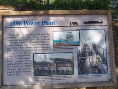
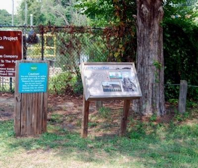
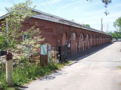
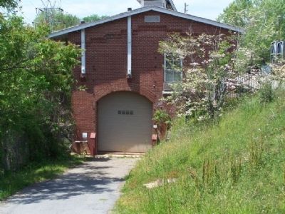
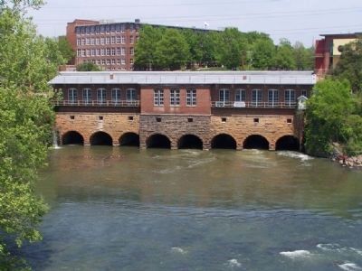
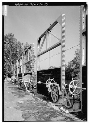
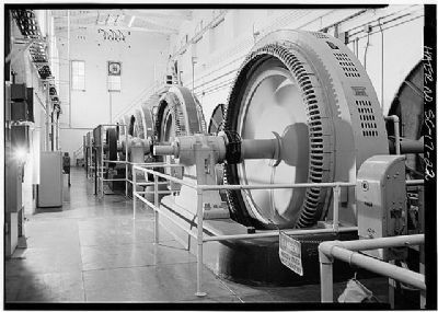
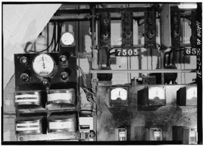
To meet growing demands for electricity, the Columbia Water and Power Company constructed this power plant, the Columbia Hydro Plant, in 1896. It replaced the 1894 power facility upstream. This Hydro Plant provided power for city lights, trolleys and manufacturing plants. Still operating with its original turbines, it is owned by the City of Columbia, and operated by SCG&E. The brick powerhouse contains seven turbine-generators with a total of 10,600 kilowatts, and produces about 48 million kilowatts per year.
Erected by SC State Museum.
Topics. This historical marker is listed in these topic lists: Industry & Commerce • Waterways & Vessels. A significant historical year for this entry is 1896.
Location. 33° 59.821′ N, 81° 2.94′ W. Marker is in Columbia, South Carolina, in Richland County. It is in Midtown - Downtown. Marker can be reached from the intersection of Gervais Street (U.S. 1/378) and Gist Street. At River's edge opposite Gist St. Touch for map. Marker is in this post office area: Columbia SC 29201, United States of America. Touch for directions.
Other nearby markers. At least 10 other markers are within walking distance of this marker. Gervais Street Bridge (a few steps from this marker); Harnessing Water Power (within shouting distance of this marker); Columbia Canal (within shouting distance of this marker); Congaree River Bridges (within shouting distance of this marker); Doolittle Raiders (about 500 feet away, measured in a direct line); Williams Street / Gist Street (about 600 feet away); Huger Street (approx. ¼ mile away); Milestones (approx. ¼ mile away); Old Congaree River Bridges (approx. ¼ mile away); Friday’s Ferry (approx. ¼ mile away). Touch for a list and map of all markers in Columbia.
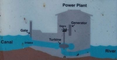
Regarding 1896 Power Plant. Picture 1; Simplified diagram of the power plant's
energy producing components.
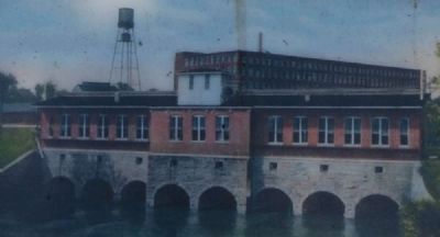
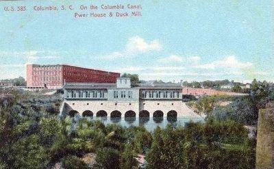
Picture 2,lower left; This station was completed
in 1896,after the original one to the north proved inadequate to provide the necessary power for the Duck Mill (now the State Museum) in the background, c.1910.
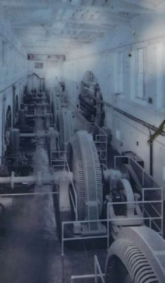
Picture 3,right; Interior view of the generators,looking south.
Also see . . . Columbia Canal. The Columbia Canal has played an important role in the commercial and industrial development of Columbia. (Submitted on September 7, 2009, by Brian Scott of Anderson, South Carolina.)
Additional commentary.
1. City hopes to make hydro plant a tourist spot
by Adam Beam
February 07, 2011
The State
Columbia officials are negotiating with a private company to operate the city’s hydroelectric power plant, hoping the century-old building can find new life as a tourist attraction and generate new revenue for the city.
The city has owned the plant since 2002, when SCE&G passed it to Columbia as part of the deal that also transferred ownership of the metro Columbia bus system to the Central Midlands Regional Transit Authority.
But over the past decade, the plant has failed to be the power generator the city hoped it would be because of continued years of drought, according to city officials.
The plan was for SCE&G to continue to operate the plant and give the city a $1 million credit on its power bill every year. SCE&G gave the city the power credit, but for many years the plant failed to generate $1 million worth of electricity. The result left the city owing SCE&G $3.2 million, a debt the city will pay back, interest-free, over the next five years.
City officials are negotiating with Lockhart Power, a small public utility company in the Upstate, to take over the plant’s operation. The company has about 13,500 customers and already operates a hydroelectric power plant. An ordinance authorizing the city
manager to negotiate a lease with Lockhart has been on the City Council’s agenda twice but has been delayed both times.
The plant is at the mouth of the Columbia Canal, between the Gervais Street bridge and the EdVenture Children’s museum, where the city is spending $6 million to build a park that will connect to the city’s popular Riverfront Park. City officials hope to incorporate the power plant into the park, cleaning it up and making it available for tours.
“We’re talking about putting a lot of investment in it and making it where kids can come, schools can come and be part of the tours,” City Councilman Daniel Rickenmann said.
Specifically, City Manager Steve Gantt said he wants EdVenture to include the plant as an educational exhibit on how to use water as a renewable energy source.
“The (company) we’re dealing with is very sensitive to the fact that it is historic, and they would like to provide some educational opportunities with the building,” Gantt said. “We hope to transform the exterior of that building back into its original condition, put windows back in and make it look like it did 100 years ago.”
The Columbia Canal has been many things over its nearly 200-year history, including a bypass for ships and home to a Confederate gunpowder factory during the Civil War. Built in 1819 by the state,
the canal originally was intended as a way for riverboats to bypass the rapids on the Broad River.
By 1843, railroads had made the canal obsolete.
Over the next five decades, the state would lease the canal to three companies. All of them failed as businesses, reverting control of the canal back to the state. It wasn’t until 1896, when the Columbia Water Power Co. built the hydroelectric power plant, that the canal found its true calling: generating electricity.
The plant gave power to the Columbia Cotton Duck Mill, one of the first electrically powered textile mills in the world and now the site of the State Museum. The power plant later provided power to the Granby and Olympia mills, transforming the Midlands economy, according to Karen Kustafik, a former park ranger and now stormwater environmental specialist for Columbia.
“Once this (power plant) started, it really spurred the growth of textiles,” she said.
The mills since have closed, and the canal has found yet another use: providing drinking water for Richland County. But the hydro-power plant is still in operation, with two turbines spinning constantly, two others disabled and three more on standby.
— Submitted July 25, 2011, by Brian Scott of Anderson, South Carolina.
Credits. This page was last revised on February 16, 2023. It was originally submitted on April 26, 2008, by Mike Stroud of Bluffton, South Carolina. This page has been viewed 2,022 times since then and 76 times this year. Photos: 1. submitted on April 26, 2008, by Mike Stroud of Bluffton, South Carolina. 2, 3, 4. submitted on July 25, 2011, by Brian Scott of Anderson, South Carolina. 5. submitted on September 7, 2009, by Brian Scott of Anderson, South Carolina. 6, 7, 8. submitted on April 26, 2008, by Mike Stroud of Bluffton, South Carolina. 9, 10, 11. submitted on May 29, 2010, by Mike Stroud of Bluffton, South Carolina. 12. submitted on October 2, 2015. • Craig Swain was the editor who published this page.
