Millburn in Essex County, New Jersey — The American Northeast (Mid-Atlantic)
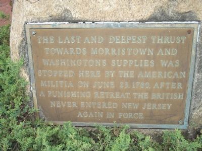
Last British Thrust into New Jersey
Topics. This historical marker is listed in this topic list: War, US Revolutionary. A significant historical month for this entry is June 1882.
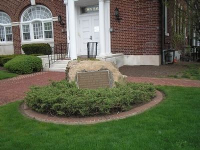
Location. 40° 43.412′ N, 74° 18.54′ W. Marker is in Millburn, New Jersey, in Essex County. Marker is on Millburn Avenue (County Route 527/577), on the left when traveling east. Marker is located in front of the Millburn Municipal Building on Millburn Avenue. Touch for map. Marker is at or near this postal address: 375 Millburn Ave, Millburn NJ 07041, United States of America. Touch for directions.
Other nearby markers. At least 8 other markers are within walking distance of this marker. Baldwin Court (approx. 0.3 miles away); Paper Mill Playhouse (approx. 0.3 miles away); Angelo Del Rossi (approx. 0.3 miles away); Washington Rock (approx. 0.6 miles away); First Meeting of the Wyoming Presbyterian Church (approx. 0.7 miles away); The Battle of Springfield (approx. 0.8 miles away); Springfield (approx. 0.9 miles away); Colonial Church (approx. 0.9 miles away). Touch for a list and map of all markers in Millburn.
Also see . . . The Battles of Connecticut Farms and Springfield. (Submitted on April 26, 2008, by Bill Coughlin of Woodland Park, New Jersey.)
Credits. This page was last revised on June 16, 2016. It was originally submitted on April 26, 2008, by Bill Coughlin of Woodland Park, New Jersey. This page has been viewed 1,426 times since then and 23 times this year. Photos: 1, 2, 3. submitted on April 26, 2008, by Bill Coughlin of Woodland Park, New Jersey. • Craig Swain was the editor who published this page.


