Parkersburg in Wood County, West Virginia — The American South (Appalachia)
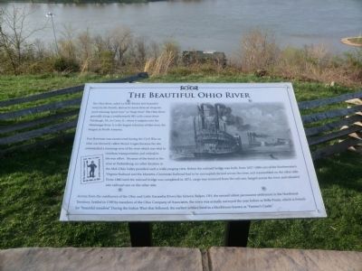
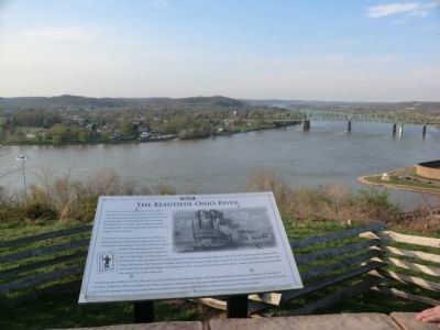
The Beautiful Ohio River
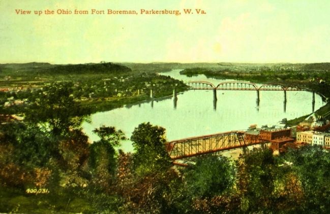
Fort Boreman was constructed during the Civil War on what was formerly called Mount Logan because the site commanded a stunning view of the river which was vital to riverboat transportation and critical to the war effort. Because of the bend in the river at Parkersburg, no other location in Mid-Ohio Valley provided such a wide-ranging view. Before the railroad bridge was built, from 1857-1860 cars of the Northwestern Virginia Railroad and the Marietta-Cincinnati Railroad had to be uncoupled, ferried across the river, and reassembled on the other side. From 1860 until the railroad bridge was completed in 1871, cargo was removed from the rail cars, barged across the river, and reloaded into railroad cars on the other side.
Across from the confluence of the Ohio and Little Kanawha Rivers lies historic Belpre, OH, the second oldest permanent settlement in the Northwest Territory. Settled in 1789 by members of the Ohio Company of Associates, the town was actually surveyed the year before as Belle Prarie, which is French for “beautiful meadow.” During the Indian Wars that followed, the earliest settlers lived in a blockhouse known as “Farmer’s Castle.”
Topics. This memorial is listed in these topic lists: Industry & Commerce • War, US Civil. A significant historical year for this entry is 1860.
Location. This marker has been replaced by another marker nearby. It was located near 39° 15.761′ N, 81° 34.171′ W. Marker was in Parkersburg, West Virginia, in Wood County. Memorial was on Fort Boreman Drive, one mile south of Robert Byrd Highway (U.S. 50). The marker is located in Fort Boreman Park. Touch for map. Marker was in this post office area: Parkersburg WV 26101, United States of America. Touch for directions.
Other nearby markers. At least 8 other markers are within walking distance of this location. A different marker also named The Beautiful Ohio River (here, next to this marker); Historic Parkersburg (West) Virginia (here, next to this marker); Historic Blennerhassett Island (a few steps from this marker); Parkersburg and the Civil War (a few steps from this marker); Fort Boreman (a few steps from this marker); a different marker also named Fort Boreman (within shouting distance of this marker); William L. “Mudwall” Jackson (within shouting distance of this marker); Welcome (within shouting distance of this marker). Touch for a list and map of all markers in Parkersburg.
Related marker. Click here for another marker that is related to this marker. New Marker At This Location also titled "The Beautiful Ohio River".
Credits. This page was last revised on January 9, 2022. It was originally submitted on May 10, 2014, by Don Morfe of Baltimore, Maryland. This page has been viewed 506 times since then and 21 times this year. Photos: 1, 2. submitted on May 10, 2014, by Don Morfe of Baltimore, Maryland. 3. submitted on December 25, 2014. • Bill Pfingsten was the editor who published this page.


